Circles of latitude between the 50th parallel north and the 55th parallel north
Following are circles of latitude between the 50th parallel north and the 55th parallel north:
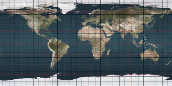
51st parallel north
.svg.png)
The 51st parallel north is a circle of latitude that is 51 degrees north of the Earth's equatorial plane. It crosses Europe, Asia, the Pacific Ocean, North America, and the Atlantic Ocean.
At this latitude the sun is visible for 16 hours, 33 minutes during the summer solstice and 7 hours, 55 minutes during the winter solstice.[1]
Capital cities between the 51st and 52nd parallels are London and Astana.
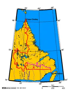
Russian America 1799–1824/25
In 1799 Paul I, Tsar of the Russian Empire, issued a ukase creating the Russian-American Company (RAC). It was granted monopolistic control north of the 55th parallel north, which had been the Russian claim since 1790, as well as the right to operate and occupy territory to the south as long as the lands had not been previously occupied, or dependent on any other nation.[2] In 1821 the RAC's charter was renewed and at the same time an ukase proclaimed that Russian sovereignty extended south to the 51st parallel, and that waters north of that line were closed to foreign shipping. The ukase was met with strong objections by the United States and Great Britain. Subsequent negotiations resulted in a clear and permanent boundary for Russian America, the southward terminus of which was established at 54°40′ north.[3]
Around the world
Starting at the Prime Meridian (just north of the Sheffield Park Garden in East Sussex, England) and heading eastwards, the parallel 51° north passes through:
Coordinates Country, territory or sea Notes 51°0′N 0°0′E / 51.000°N 0.000°E  United Kingdom
England: East Sussex, Kent (just south of Dover) 51°0′N 1°30′E / 51.000°N 1.500°E Strait of Dover Crosses the Channel Tunnel 51°0′N 2°0′E / 51.000°N 2.000°E  France
Nord-Pas-de-Calais — passing just south of Dunkirk and the northernmost point of France 51°0′N 2°34′E / 51.000°N 2.567°E .svg.png) Belgium
BelgiumPassing all 5 provinces of Flanders 51°0′N 5°46′E / 51.000°N 5.767°E  Netherlands
Limburg — for about 10 km (6.2 mi) — passing through Sittard 51°0′N 5°54′E / 51.000°N 5.900°E  Germany
North Rhine-Westphalia — passing through northern Cologne
Hesse
Thuringia — passing through Erfurt
Saxony-Anhalt
Thuringia
Saxony — passing just south of Dresden51°0′N 14°15′E / 51.000°N 14.250°E  Czech Republic
51°0′N 14°34′E / 51.000°N 14.567°E GermanySaxony 51°0′N 14°55′E / 51.000°N 14.917°E  Poland
For about 4 km (2.5 mi) 51°0′N 14°58′E / 51.000°N 14.967°E Czech Republic51°0′N 15°6′E / 51.000°N 15.100°E PolandFor about 3 km (1.9 mi) 51°0′N 15°8′E / 51.000°N 15.133°E Czech RepublicFor about 3 km (1.9 mi) 51°0′N 15°10′E / 51.000°N 15.167°E PolandPassing just south of Wrocław 51°0′N 23°57′E / 51.000°N 23.950°E  Ukraine
Volyn oblast — passing just north of Lutsk
Rivne Oblast
Zhytomyr Oblast — passing just north of Korosten
Kyiv Oblast — passing through Kyiv Reservoir
Chernihiv Oblast — passing just south of Nizhyn
Sumy Oblast — passing just north of Sumy51°0′N 35°20′E / 51.000°N 35.333°E  Russia
51°0′N 49°19′E / 51.000°N 49.317°E  Kazakhstan
West Kazakhstan Region — passing just south of Oral, Kazakhstan 51°0′N 54°11′E / 51.000°N 54.183°E RussiaFor about 25 km (15.5 mi) 51°0′N 54°33′E / 51.000°N 54.550°E KazakhstanFor about 14 km (8.7 mi) 51°0′N 54°46′E / 51.000°N 54.767°E RussiaFor about 118 km (73 mi) 51°0′N 56°27′E / 51.000°N 56.450°E KazakhstanFor about 11 km (6.8 mi) 51°0′N 56°36′E / 51.000°N 56.600°E RussiaFor about 9 km (5.5 mi) 51°0′N 56°44′E / 51.000°N 56.733°E KazakhstanFor about 39 km (24 mi) 51°0′N 57°18′E / 51.000°N 57.300°E RussiaFor about 32 km (19.8 mi) 51°0′N 57°45′E / 51.000°N 57.750°E KazakhstanFor about 61 km (37 mi) 51°0′N 58°37′E / 51.000°N 58.617°E RussiaFor about 199 km (123 mi) 51°0′N 61°30′E / 51.000°N 61.500°E KazakhstanKostanay Region Akmola Region — passing just south of Derzhavinsk
Passing just south of Astana
Karaganda Region
East Kazakhstan Region
51°0′N 79°53′E / 51.000°N 79.883°E RussiaFor about 42 km (26 mi) 51°0′N 80°29′E / 51.000°N 80.483°E KazakhstanFor about 42 km (26 mi) 51°0′N 81°04′E / 51.000°N 81.067°E RussiaFor about 143 km (89 mi) 51°0′N 83°06′E / 51.000°N 83.100°E KazakhstanFor about 5 km (3.1 mi) 51°0′N 83°11′E / 51.000°N 83.183°E RussiaFor about 2 km (1.2 mi) 51°0′N 83°12′E / 51.000°N 83.200°E KazakhstanFor about 15 km (9.3 mi) 51°0′N 97°50′E / 51.000°N 97.833°E  Mongolia
Passing Lake Khövsgöl 51°0′N 102°15′E / 51.000°N 102.250°E Russia51°0′N 119°37′E / 51.000°N 119.617°E  People's Republic of China
Inner Mongolia
Heilongjiang51°0′N 127°0′E / 51.000°N 127.000°E Russia51°0′N 140°38′E / 51.000°N 140.633°E Strait of Tartary 51°0′N 142°14′E / 51.000°N 142.233°E RussiaIsland of Sakhalin 51°0′N 143°36′E / 51.000°N 143.600°E Sea of Okhotsk 51°0′N 156°46′E / 51.000°N 156.767°E RussiaKamchatka Peninsula 51°0′N 156°51′E / 51.000°N 156.850°E Pacific Ocean Passing just south of Amatignak Island, Alaska, .png) United States
United States
Passing just north of Vancouver Island, British Columbia,.svg.png) Canada
Canada51°0′N 127°31′W / 51.000°N 127.517°W CanadaBritish Columbia — passing through city of Revelstoke
Alberta — passing through city of Calgary
Saskatchewan
Manitoba - passing just south of the city of Dauphin
Ontario - passing just south of the town of Red Lake
Passing just south of the tip of James Bay (51°10′N 79°50′W / 51.167°N 79.833°W)
Quebec51°0′N 58°48′W / 51.000°N 58.800°W Gulf of Saint Lawrence 51°0′N 57°3′W / 51.000°N 57.050°W CanadaNewfoundland and Labrador — island of Newfoundland 51°0′N 55°50′W / 51.000°N 55.833°W Atlantic Ocean Passing just north of Groais Island, Newfoundland and Labrador, Canada51°0′N 4°32′W / 51.000°N 4.533°W United KingdomEngland — Devon, Dorset, Wiltshire, Hampshire (passing just north of Southampton), West Sussex, East Sussex
52nd parallel north
The 52nd parallel north is a circle of latitude that is 52 degrees north of the Earth's equatorial plane. It crosses Europe, Asia, the Pacific Ocean, North America, and the Atlantic Ocean.
In Canada, part of the legally defined border between Quebec and Newfoundland and Labrador is defined by the parallel, though Quebec maintains a dormant claim to some of the territory north of this line.[4]
The catchment area of London, the capital city of England and the United Kingdom, can be broadly defined by the 51st and 52nd parallels.
At this latitude the sun is visible for 16 hours, 44 minutes during the summer solstice and 7 hours, 45 minutes during the winter solstice.[5]
Around the world

Starting at the Prime Meridian (just west of the village of Barkway in Hertfordshire, England) and heading eastwards, the parallel 52° north passes through:
53rd parallel north
The 53rd parallel north is a circle of latitude that is 53 degrees north of the Earth's equatorial plane. It crosses Europe, Asia, the Pacific Ocean, North America, and the Atlantic Ocean.
At this latitude the sun is visible for 16 hours, 56 minutes during the summer solstice and 7 hours, 34 minutes during the winter solstice. Approximately 53°20′ North, 37 km (23 mi) north of this parallel, during the June summer solstice, the sun is visible for 17 hours exactly. If the latitude in the northern hemisphere is 53°47′ or smaller, it is possible to view both astronomical dawn and dusk every day of the month of August.[7]
One minute of longitude along the 53rd parallel is approximately 0.6042 nautical miles (1,224 yd; 1.119 km). One degree of longitude along the 53rd parallel is about 36.252 nautical miles (41.72 mi; 67.14 km).
Around the world
Starting at the Prime Meridian (northeast of Boston, Lincolnshire, England) and heading eastwards, the parallel 53° north passes through:
54th parallel north
The 54th parallel north is a circle of latitude that is 54 degrees north of the Earth's equatorial plane. It crosses Europe, Asia, the Pacific Ocean, North America, and the Atlantic Ocean.
At this latitude, the sun is visible for 17 hours, 9 minutes during the summer solstice and 7 hours, 22 minutes during the winter solstice.[8]
Around the world

.jpg)
Starting at the Prime Meridian (in the North Sea southeast of Bridlington, East Riding of Yorkshire, England) and heading eastwards, the parallel 54° north passes through:
55th parallel north
The 55th parallel north is a circle of latitude that is 55 degrees north of the Earth's equatorial plane. It crosses Europe, Asia, the Pacific Ocean, North America, and the Atlantic Ocean.
At this latitude the sun is visible for 17 hours, 22 minutes during the summer solstice and 7 hours, 10 minutes during the winter solstice.[9]
This latitude also roughly corresponds to the minimum latitude in which nautical twilight can last all night near the summer solstice.
The 55th parallel serves as the southern boundary of Nunavik territory in Quebec.
Around the world
Starting at the Prime Meridian and heading eastwards, the parallel 55° north passes through:
Notable cities and towns on 55°N
- Chelyabinsk, Chelyabinsk Oblast, Russia
- Omsk, Omsk Oblast, Russia
- Novosibirsk, Novosibirsk Oblast, Russia
- Khimki, Moscow Oblast, Russia
- Moscow, Russia
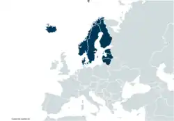
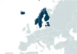
- Copenhagen, Denmark
- Odense, Denmark
- Klaipėda, Lithuania
- Šiauliai, Lithuania
- Panevėžys, Lithuania
- Daugavpils, Latvia
- Vitebsk, Belarus
- Derry, Northern Ireland, UK
- Newcastle upon Tyne, England, UK
- South Shields, England, UK.
- Thompson, Manitoba, Canada
- Grande Prairie, Alberta, Canada
See also
References
- ↑ "Duration of Daylight/Darkness Table for One Year". U.S. Naval Observatory. 2019-09-24. Archived from the original on 2019-10-12. Retrieved 2021-03-10.
- ↑ United States, Bering Sea Tribunal of Arbitration (1892). Fur-seal Arbitration: The Case of the United States before the Tribunal of Arbitration to convene at Paris under the provisions of the treaty between the United States of America and Great Britain, concluded February 29, 1892. United States Government Printing Office. p. 14. OCLC 68198841.
- ↑ Haycox, Stephen W. (2002). Alaska: An American Colony. University of Washington Press. pp. 1118–1122. ISBN 978-0-295-98249-6.
- 1 2 Jacobs, Frank (2012-07-10). "Oh, (No) Canada!". Opinionator: Borderlines. The New York Times. Archived from the original on 2019-10-01. Retrieved 2012-09-23.
- ↑ "Duration of Daylight/Darkness Table for One Year". United States Naval Observatory. 2019-09-24. Archived from the original on 2019-10-12. Retrieved 2021-03-10.
- ↑ "52° North: a tangible timeline". TU Delft. Retrieved 2019-05-29.
- ↑ "Duration of Daylight/Darkness Table for One Year". Archived from the original on October 12, 2019.
- ↑ "Duration of Daylight/Darkness Table for One Year". Archived from the original on October 12, 2019.
- ↑ "Duration of Daylight/Darkness Table for One Year". U.S. Naval Observatory. 2019-09-24. Archived from the original on 2019-10-12. Retrieved 2021-03-10.
Circles of latitude / meridians | |
|---|---|
45x90
45x90
45x90
45x90
|