Laran District
Laran District
Persian: بخش لاران | |
|---|---|
District | |
 Laran District | |
| Coordinates: 32°23′36″N 50°32′36″E / 32.39333°N 50.54333°E[1] | |
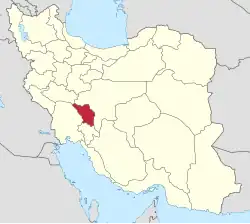
| Country | Iran |
| Province | Chaharmahal and Bakhtiari |
| County | Shahrekord |
| Established | 1997[2] |
| Capital | Sureshjan |
| Population (2016)[3] | |
• Total | 32,863 |
| Time zone | UTC+3:30 (IRST) |
Laran District (Persian: بخش لاران) is in Shahrekord County, Chaharmahal and Bakhtiari province, Iran. Its capital is the city of Sureshjan.[2]
History
The village of Haruni was elevated to the status of a city in 2013.[4]
Demographics
Population
At the time of the 2006 National Census, the district's population was 32,705 in 7,566 households.[5] The following census in 2011 counted 32,791 people in 8,882 households.[6] The 2016 census measured the population of the district as 32,863 inhabitants living in 9,656 households.[3]
Administrative divisions
| Administrative Divisions | 2006[5] | 2011[6] | 2016[3] |
|---|---|---|---|
| Lar RD | 13,824 | 13,877 | 9,075 |
| Margh Malek RD | 2,342 | 2,097 | 2,298 |
| Haruni (city) | 3,601 | ||
| Sudjan (city) | 5,415 | 5,410 | 5,581 |
| Sureshjan (city) | 11,124 | 11,407 | 12,308 |
| Total | 32,705 | 32,791 | 32,863 |
| RD = Rural District | |||
See also
![]() Iran portal
Iran portal
References
- ↑ OpenStreetMap contributors (31 August 2024). "Laran District (Shahrekord County)" (Map). OpenStreetMap (in Persian). Retrieved 31 August 2024.
- 1 2 Habibi, Hassan (10 September 2012) [Approved 17 April 1376]. Making changes in the national divisions of Chaharmahal and Bakhtiari province. rc.majlis.ir (Report) (in Persian). Ministry of the Interior, Political-Defense Commission of the Government Board. Proposal 1.4.42.14643; Notification 56142/T17937K. Archived from the original on 30 November 2012. Retrieved 2 December 2023 – via Research Center of the Islamic Consultative Assembly of Iran.
- 1 2 3 Census of the Islamic Republic of Iran, 1395 (2016): Chaharmahal and Bakhtiari Province. amar.org.ir (Report) (in Persian). The Statistical Center of Iran. Archived from the original (Excel) on 24 May 2019. Retrieved 19 December 2022.
- ↑ "Haruni village of Shahrekord County was upgraded to a city". irna.ir (in Persian). Shura Majlis. 2 January 2013. Archived from the original on 31 August 2024. Retrieved 31 August 2024 – via Islamic Republic News Agency.
- 1 2 Census of the Islamic Republic of Iran, 1385 (2006): Chaharmahal and Bakhtiari Province. amar.org.ir (Report) (in Persian). The Statistical Center of Iran. Archived from the original (Excel) on 20 September 2011. Retrieved 25 September 2022.
- 1 2 Census of the Islamic Republic of Iran, 1390 (2011): Chaharmahal and Bakhtiari Province. irandataportal.syr.edu (Report) (in Persian). The Statistical Center of Iran. Archived from the original (Excel) on 16 January 2023. Retrieved 19 December 2022 – via Iran Data Portal, Syracuse University.
Chaharmahal and Bakhtiari province, Iran | |||||||||||||||||||||||
|---|---|---|---|---|---|---|---|---|---|---|---|---|---|---|---|---|---|---|---|---|---|---|---|
| Capital |
|  | |||||||||||||||||||||
| Counties and cities |
| ||||||||||||||||||||||
| Landmarks |
| ||||||||||||||||||||||
| populated places |
| ||||||||||||||||||||||
| Capital |
| ||||||||||||||||||||||||||||||||||||||||
|---|---|---|---|---|---|---|---|---|---|---|---|---|---|---|---|---|---|---|---|---|---|---|---|---|---|---|---|---|---|---|---|---|---|---|---|---|---|---|---|---|---|
| Districts |
| ||||||||||||||||||||||||||||||||||||||||
This article is issued from Wikipedia. The text is licensed under Creative Commons - Attribution - Sharealike. Additional terms may apply for the media files.