Yaseh Chah
Yaseh Chah
Persian: ياسه چا | |
|---|---|
Village | |
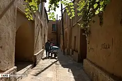 Street in Yaseh Chah | |
 Yaseh Chah | |
| Coordinates: 32°37′33″N 50°50′56″E / 32.62583°N 50.84889°E[1] | |
| Country | Iran |
| Province | Chaharmahal and Bakhtiari |
| County | Saman |
| District | Zayandehrud |
| Rural District | Hureh |
| Population (2016)[2] | |
• Total | 586 |
| Time zone | UTC+3:30 (IRST) |
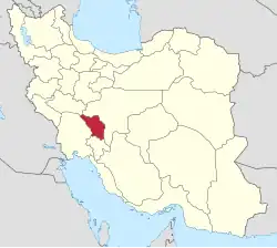
Yaseh Chah (Persian: ياسه چا)[a] is a village in Hureh Rural District of Zayandehrud District in Saman County, Chaharmahal and Bakhtiari province, Iran.
Demographics
Ethnicity
The village is populated by Turkic people.[4]
Population
At the time of the 2006 National Census, the village's population was 702 in 222 households, when it was in the former Saman District of Shahrekord County.[5] The following census in 2011 counted 762 people in 238 households.[6] The 2016 census measured the population of the village as 586 people in 198 households,[2] by which time the district had been separated from the county in the establishment of Saman County. The rural district was transferred to the new Zayandehrud District.[7]
See also
![]() Iran portal
Iran portal
Notes
References
- ↑ OpenStreetMap contributors (11 March 2025). "Yaseh Chah, Saman County" (Map). OpenStreetMap (in Persian). Retrieved 11 March 2025.
- 1 2 Census of the Islamic Republic of Iran, 1395 (2016): Chaharmahal and Bakhtiari Province. amar.org.ir (Report) (in Persian). The Statistical Center of Iran. Archived from the original (Excel) on 24 May 2019. Retrieved 19 December 2022.
- ↑ Yaseh Chah can be found at GEOnet Names Server, at this link, by opening the Advanced Search box, entering "-3088545" in the "Unique Feature Id" form, and clicking on "Search Database".
- ↑ "Language distribution: Chahar Mahal va Bakhtiari Province". Iran Atlas. Retrieved 25 March 2021.
- ↑ Census of the Islamic Republic of Iran, 1385 (2006): Chaharmahal and Bakhtiari Province. amar.org.ir (Report) (in Persian). The Statistical Center of Iran. Archived from the original (Excel) on 20 September 2011. Retrieved 25 September 2022.
- ↑ Census of the Islamic Republic of Iran, 1390 (2011): Chaharmahal and Bakhtiari Province. irandataportal.syr.edu (Report) (in Persian). The Statistical Center of Iran. Archived from the original (Excel) on 16 January 2023. Retrieved 19 December 2022 – via Iran Data Portal, Syracuse University.
- ↑ Rahimi, Mohammad Reza (21 October 1391) [Approved 29 September 1391]. Letter of approval regarding national divisions in Chaharmahal and Bakhtiari province. rc.majlis.ir (Report) (in Persian). Ministry of the Interior, Council of Ministers. Notification 200671/T47661H. Archived from the original on 10 January 2013. Retrieved 6 November 2023 – via Research Center of the System of Laws of the Islamic Council of Farabi Mobile Library.
Chaharmahal and Bakhtiari province, Iran | |||||||||||||||||||||||
|---|---|---|---|---|---|---|---|---|---|---|---|---|---|---|---|---|---|---|---|---|---|---|---|
| Capital |
|  | |||||||||||||||||||||
| Counties and cities |
| ||||||||||||||||||||||
| Landmarks |
| ||||||||||||||||||||||
| populated places |
| ||||||||||||||||||||||
This article is issued from Wikipedia. The text is licensed under Creative Commons - Attribution - Sharealike. Additional terms may apply for the media files.