Arjenak, Chaharmahal and Bakhtiari
Arjenak
Persian: ارجنك | |
|---|---|
Village | |
 Arjenak | |
| Coordinates: 32°25′40″N 50°39′10″E / 32.42778°N 50.65278°E[1] | |
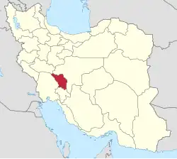
| Country | Iran |
| Province | Chaharmahal and Bakhtiari |
| County | Shahrekord |
| District | Central |
| Rural District | Howmeh |
| Population (2016)[2] | |
• Total | 951 |
| Time zone | UTC+3:30 (IRST) |
Arjanak (Persian: ارجنك)[a] is a village in Howmeh Rural District of the Central District in Shahrekord County, Chaharmahal and Bakhtiari province, Iran.
Demographics
Ethnicity
Population
At the time of the 2006 National Census, the village's population was 1,234 in 325 households.[6] The following census in 2011 counted 1,102 people in 312 households.[7] The 2016 census measured the population of the village as 951 people in 284 households.[2]
See also
![]() Iran portal
Iran portal
Notes
References
- ↑ OpenStreetMap contributors (12 March 2025). "Arjenak, Shahrekord County" (Map). OpenStreetMap (in Persian). Retrieved 12 March 2025.
- 1 2 Census of the Islamic Republic of Iran, 1395 (2016): Chaharmahal and Bakhtiari Province. amar.org.ir (Report) (in Persian). The Statistical Center of Iran. Archived from the original (Excel) on 24 May 2019. Retrieved 19 December 2022.
- ↑ Arjenak can be found at GEOnet Names Server, at this link, by opening the Advanced Search box, entering "-3053652" in the "Unique Feature Id" form, and clicking on "Search Database".
- ↑ "Language distribution: Chahar Mahal va Bakhtiari Province". Iran Atlas. Archived from the original on 4 December 2017. Retrieved 25 March 2021.
- ↑ Anonby, Erik. "Atlas of the Languages of Iran: A working classification". Iran Atlas. Archived from the original on 29 December 2019. Retrieved 27 March 2021.
- ↑ Census of the Islamic Republic of Iran, 1385 (2006): Chaharmahal and Bakhtiari Province. amar.org.ir (Report) (in Persian). The Statistical Center of Iran. Archived from the original (Excel) on 20 September 2011. Retrieved 25 September 2022.
- ↑ Census of the Islamic Republic of Iran, 1390 (2011): Chaharmahal and Bakhtiari Province. irandataportal.syr.edu (Report) (in Persian). The Statistical Center of Iran. Archived from the original (Excel) on 16 January 2023. Retrieved 19 December 2022 – via Iran Data Portal, Syracuse University.
Chaharmahal and Bakhtiari province, Iran | |||||||||||||||||||||||
|---|---|---|---|---|---|---|---|---|---|---|---|---|---|---|---|---|---|---|---|---|---|---|---|
| Capital |
|  | |||||||||||||||||||||
| Counties and cities |
| ||||||||||||||||||||||
| Landmarks |
| ||||||||||||||||||||||
| populated places |
| ||||||||||||||||||||||
| Capital |
| ||||||||||||||||||||||||||||||||||||||||
|---|---|---|---|---|---|---|---|---|---|---|---|---|---|---|---|---|---|---|---|---|---|---|---|---|---|---|---|---|---|---|---|---|---|---|---|---|---|---|---|---|---|
| Districts |
| ||||||||||||||||||||||||||||||||||||||||
This article is issued from Wikipedia. The text is licensed under Creative Commons - Attribution - Sharealike. Additional terms may apply for the media files.