Robat-e Jaz Rural District
Robat-e Jaz Rural District
Persian: دهستان رباط جز | |
|---|---|
Rural District | |
 Robat-e Jaz Rural District | |
| Coordinates: 36°30′48″N 57°58′07″E / 36.51333°N 57.96861°E[1] | |
| Country | Iran |
| Province | Razavi Khorasan |
| County | Khoshab |
| District | Central |
| Capital | Robat-e Jaz |
| Population (2016)[2] | |
• Total | 3,294 |
| Time zone | UTC+3:30 (IRST) |
Robat-e Jaz Rural District (Persian: دهستان رباط جز) is in the Central District of Khoshab County, Razavi Khorasan province, Iran.[3] Its capital is the village of Robat-e Jaz.[4]
Demographics
Population
At the time of the 2006 National Census, the rural district's population (as a part of the former Khoshab District of Sabzevar County) was 3,221 in 886 households.[5] There were 3,242 inhabitants in 998 households at the following census of 2011,[6] by which time the district had been separated from the county in the establishment of Khoshab County. The rural district was transferred to the new Central District.[3] The 2016 census measured the population of the rural district as 3,294 in 1,074 households. The most populous of its four villages was Robat-e Jaz, with 3,037 people.[2]
See also
![]() Iran portal
Iran portal
References
- ↑ OpenStreetMap contributors (2 November 2024). "Robat-e Jaz Rural District (Khoshab County)" (Map). OpenStreetMap (in Persian). Retrieved 2 November 2024.
- 1 2 Census of the Islamic Republic of Iran, 1395 (2016): Razavi Khorasan Province. amar.org.ir (Report) (in Persian). The Statistical Center of Iran. Archived from the original (Excel) on 2 April 2022. Retrieved 19 December 2022.
- 1 2 Rahimi, Mohammadreza (28 February 2013) [Approved 28 June 1389]. Approval letter regarding definitions and national divisions in Sabzevar County. rc.majlis.ir (Report) (in Persian). Ministry of the Interior, Board of Ministers. Proposal 29266/42/1/4/1; Notification 149133/T44704H. Archived from the original on 20 December 2016. Retrieved 14 November 2023 – via Islamic Parliament Research Center.
- ↑ Habibi, Hassan (c. 2018) [Approved 2 April 1372]. Approval of the formation of 27 rural districts in the provinces of Khorasan, Sistan and Baluchestan, Mazandaran, Tehran, Yazd, and Hormozgan. qavanin.ir (Report) (in Persian). Ministry of the Interior, Political-Defense Commission of the Government Board. Resolution 93808/T907. Archived from the original on 28 November 2018. Retrieved 8 January 2024 – via Laws and Regulations Portal of the Islamic Republic of Iran.
- ↑ Census of the Islamic Republic of Iran, 1385 (2006): Razavi Khorasan Province. amar.org.ir (Report) (in Persian). The Statistical Center of Iran. Archived from the original (Excel) on 20 September 2011. Retrieved 25 September 2022.
- ↑ Census of the Islamic Republic of Iran, 1390 (2011): Razavi Khorasan Province. irandataportal.syr.edu (Report) (in Persian). The Statistical Center of Iran. Archived from the original (Excel) on 20 January 2023. Retrieved 19 December 2022 – via Iran Data Portal, Syracuse University.
Razavi Khorasan province | ||
|---|---|---|
| Capital | 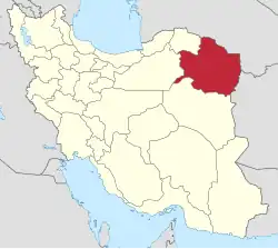 | |
| Counties and cities | ||
| Landmarks |
| |
| General |
| |
| Capital | |||||||||||||||||||||||
|---|---|---|---|---|---|---|---|---|---|---|---|---|---|---|---|---|---|---|---|---|---|---|---|
| Districts |
| ||||||||||||||||||||||