Samiabad-e Arbab Din Mohammad
Samiabad-e Arbab Din Mohammad
Persian: سميع ابادارباب دين محمد | |
|---|---|
City | |
 Samiabad-e Arbab Din Mohammad | |
| Coordinates: 35°08′49″N 60°54′17″E / 35.14694°N 60.90472°E[1] | |
| Country | Iran |
| Province | Razavi Khorasan |
| County | Torbat-e Jam |
| District | Pain Jam |
| Population (2016)[2] | |
• Total | 1,617 |
| Time zone | UTC+3:30 (IRST) |
Samiabad-e Arbab Din Mohammad (Persian: سميع ابادارباب دين محمد)[a] is a city in, and the capital of, Pain Jam District of Torbat-e Jam County, Razavi Khorasan province, Iran.[4] It is also the administrative center for Zam Rural District.[5][b]
Demographics
Population
At the time of the 2006 National Census, Samiabad-e Arbab Din Mohammad's population was 1,408 in 314 households, when it was a village in Zam Rural District.[6] The following census in 2011 counted 1,862 people in 468 households.[7] The 2016 census measured the population of the city as 1,617 people in 445 households.[2] After the census, the village was elevated to the status of a city.[4]
See also
![]() Iran portal
Iran portal
Notes
- ↑ Also romanized as Samī‘ābād-e Arbāb Dīn Moḩammad[3]
- ↑ Formerly Pain Jam Rural District
References
- ↑ OpenStreetMap contributors (6 November 2024). "Samiabad-e Arbab Din Mohammad, Torbat-e Jam County" (Map). OpenStreetMap (in Persian). Retrieved 6 November 2024.
- 1 2 Census of the Islamic Republic of Iran, 1395 (2016): Razavi Khorasan Province. amar.org.ir (Report) (in Persian). The Statistical Center of Iran. Archived from the original (Excel) on 2 April 2022. Retrieved 19 December 2022.
- ↑ Samiabad-e Arbab Din Mohammad can be found at GEOnet Names Server, at this link, by opening the Advanced Search box, entering "-3800348" in the "Unique Feature Id" form, and clicking on "Search Database".
- 1 2 Fazli, Abdolreza Rahmani (21 September 2017) [Approved 17 May 1386]. "Notification of the resolution of the Ministry of the Interior regarding the conversion of Samiabad village, the center of Pain Jam District, Torbat-e Jam County, into a city". dotic.ir (in Persian). Ministry of the Interior. Letter 33667/59806. Archived from the original on 4 December 2021. Retrieved 10 May 2023 – via Laws and Regulations Portal of Iran.
- ↑ Mousavi, Mirhossein (22 July 2016) [Approved 10 April 1366]. Creation and formation of nine rural districts including villages, fields and places in Torbat-e Jam County under Khorasan province. rc.majlis.ir (Report) (in Persian). Ministry of the Interior, Council of Ministers. Proposal 11810; Notification 116634/T879. Archived from the original on 13 July 2017. Retrieved 4 January 2024 – via Islamic Parliament Research Center of the Islamic Republic of Iran.
- ↑ Census of the Islamic Republic of Iran, 1385 (2006): Razavi Khorasan Province. amar.org.ir (Report) (in Persian). The Statistical Center of Iran. Archived from the original (Excel) on 20 September 2011. Retrieved 25 September 2022.
- ↑ Census of the Islamic Republic of Iran, 1390 (2011): Razavi Khorasan Province. irandataportal.syr.edu (Report) (in Persian). The Statistical Center of Iran. Archived from the original (Excel) on 20 January 2023. Retrieved 19 December 2022 – via Iran Data Portal, Syracuse University.
Razavi Khorasan province | ||
|---|---|---|
| Capital | 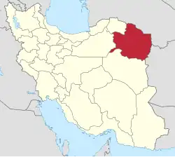 | |
| Counties and cities | ||
| Landmarks |
| |
| General |
| |
| Capital | |||||||||||||||||||||||||||||||||
|---|---|---|---|---|---|---|---|---|---|---|---|---|---|---|---|---|---|---|---|---|---|---|---|---|---|---|---|---|---|---|---|---|---|
| Districts |
| ||||||||||||||||||||||||||||||||
This article is issued from Wikipedia. The text is licensed under Creative Commons - Attribution - Sharealike. Additional terms may apply for the media files.