Nasar, Iran
Nasar
Persian: نسر | |
|---|---|
City | |
 Nasar | |
| Coordinates: 35°31′28″N 59°26′31″E / 35.52444°N 59.44194°E[1] | |
| Country | Iran |
| Province | Razavi Khorasan |
| County | Torbat-e Heydarieh |
| District | Jolgeh Rokh |
| Population (2016)[2] | |
• Total | 3,633 |
| Time zone | UTC+3:30 (IRST) |
Nasar (Persian: نسر)[a] is a city in Jolgeh Rokh District of Torbat-e Heydarieh County, Razavi Khorasan province, Iran.[4] As a village, it was the capital of Pain Rokh Rural District[5] until its capital was transferred to the village of Sar Bala.[4]
Demographics
Population
At the time of the 2006 National Census, Nasar's population was 3,403 in 876 households,[6] when it was a village in Pain Rokh Rural District. The following census in 2011 counted 3,402 people in 998 households.[7] The 2016 census measured the population of the village as 3,633 people in 1,088 households. It was the most populous village in its rural district.[2]
After the census, Nasar was elevated to the status of a city.[4]
See also
![]() Iran portal
Iran portal
Notes
References
- ↑ OpenStreetMap contributors (5 November 2024). "Nasar, Torbat-e Heydarieh County" (Map). OpenStreetMap (in Persian). Retrieved 5 November 2024.
- 1 2 Census of the Islamic Republic of Iran, 1395 (2016): Razavi Khorasan Province. amar.org.ir (Report) (in Persian). The Statistical Center of Iran. Archived from the original (Excel) on 2 April 2022. Retrieved 19 December 2022.
- ↑ Nasar can be found at GEOnet Names Server, at this link, by opening the Advanced Search box, entering "-3076572" in the "Unique Feature Id" form, and clicking on "Search Database".
- 1 2 3 Jahangiri, Ishaq (4 July 2021) [Approved 27 December 1399]. Approval regarding national divisions in Torbat-e Heydarieh County, Razavi Khorasan province. sdil.ac.ir (Report) (in Persian). Ministry of the Interior, Cabinet of Ministers. Proposal 118708; Notification 156670/T56973AH. Archived from the original on 26 March 2023. Retrieved 31 January 2025 – via Shahr Danesh Legal Research Institute.
- ↑ Mousavi, Mirhossein (3 November 2014) [Approved 10 April 1366]. Creation and establishment of 20 rural districts including villages, farms and places in Torbat-e Heydarieh County under Khorasan province. rc.majlis.ir (Report) (in Persian). Ministry of the Interior, Board of Ministers. Notification 194/T660. Archived from the original on 25 October 2014. Retrieved 4 January 2024 – via Islamic Parliament Research Center.
- ↑ Census of the Islamic Republic of Iran, 1385 (2006): Razavi Khorasan Province. amar.org.ir (Report) (in Persian). The Statistical Center of Iran. Archived from the original (Excel) on 20 September 2011. Retrieved 25 September 2022.
- ↑ Census of the Islamic Republic of Iran, 1390 (2011): Razavi Khorasan Province. irandataportal.syr.edu (Report) (in Persian). The Statistical Center of Iran. Archived from the original (Excel) on 20 January 2023. Retrieved 19 December 2022 – via Iran Data Portal, Syracuse University.
Razavi Khorasan province | ||
|---|---|---|
| Capital | 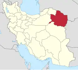 | |
| Counties and cities | ||
| Landmarks |
| |
| General |
| |
| Capital | |||||||||||||||||||||||||||||||||||||||||
|---|---|---|---|---|---|---|---|---|---|---|---|---|---|---|---|---|---|---|---|---|---|---|---|---|---|---|---|---|---|---|---|---|---|---|---|---|---|---|---|---|---|
| Districts |
| ||||||||||||||||||||||||||||||||||||||||
This article is issued from Wikipedia. The text is licensed under Creative Commons - Attribution - Sharealike. Additional terms may apply for the media files.