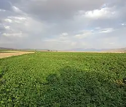
Sarpaniran Rural District
Sarpaniran Rural District
Persian: دهستان سرپنيران | |
|---|---|
Rural District | |
 | |
 Sarpaniran Rural District | |
| Coordinates: 30°02′15″N 53°21′39″E / 30.03750°N 53.36083°E[1] | |
| Country | Iran |
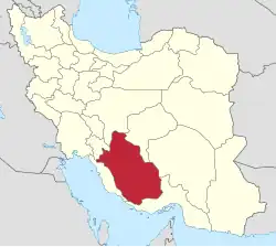
| Province | Fars |
| County | Pasargad |
| District | Central |
| Capital | Naimabad |
| Population (2016)[2] | |
• Total | 1,425 |
| Time zone | UTC+3:30 (IRST) |
Sarpaniran Rural District (Persian: دهستان سرپنيران)[3] is in the Central District of Pasargad County, Fars province, Iran.[4] Its capital is the village of Naimabad.[5]
Demographics
Population
At the time of the 2006 National Census, the rural district's population was 2,185 in 558 households.[6] There were 1,857 inhabitants in 475 households at the following census of 2011.[7] The 2016 census measured the population of the rural district as 1,425 in 435 households. The most populous of its 27 villages was Naimabad, with 424 people.[2]
See also
![]() Iran portal
Iran portal
References
- ↑ OpenStreetMap contributors (9 October 2024). "Sarpaniran Rural District (Pasargad County)" (Map). OpenStreetMap (in Persian). Retrieved 9 October 2024.
- 1 2 Census of the Islamic Republic of Iran, 1395 (2016): Fars Province. amar.org.ir (Report) (in Persian). The Statistical Center of Iran. Archived from the original (Excel) on 6 April 2022. Retrieved 19 December 2022.
- ↑ "INCSGN Search". Iranian National Committee for Standardization of Geographical Names (in Persian). Tehran: National Cartographic Center of Iran. Archived from the original on 2 May 2019.
- ↑ Aref, Mohammad Reza (c. 2021) [Approved 29 January 1384]. Divisional reforms in Fars province (Mashhad Morghab District, Madar-e Soleyman District, Abu ol Verdi District, Hakhamanish District, Pasargad County). qavanin.ir (Report) (in Persian). Ministry of the Interior, Political-Defense Commission of the Government Board. Proposal 50878/42/1/4/1; Notification 58538/T26118H. Archived from the original on 9 October 2021. Retrieved 10 December 2023 – via Laws and Regulations Portal of the Islamic Republic of Iran.
- ↑ Habibi, Hassan (c. 2018) [Approved 12 December 1371]. Creation of 48 rural districts in several rural areas of the country. qavanin.ir (Report) (in Persian). Ministry of the Interior, Political-Defense Commission of the Government Council. Proposal 4/42/11077; Resolution 93808/T907. Archived from the original on 28 November 2018. Retrieved 2 January 2024 – via Laws and Regulations Portal of the Islamic Republic of Iran.
- ↑ Census of the Islamic Republic of Iran, 1385 (2006): Fars Province. amar.org.ir (Report) (in Persian). The Statistical Center of Iran. Archived from the original (Excel) on 20 September 2011. Retrieved 25 September 2022.
- ↑ Census of the Islamic Republic of Iran, 1390 (2011): Fars Province. irandataportal.syr.edu (Report) (in Persian). The Statistical Center of Iran. Archived from the original (Excel) on 16 January 2023. Retrieved 19 December 2022 – via Iran Data Portal, Syracuse University.
Fars province, Iran | ||
|---|---|---|
| Capital |
|  |
| Counties and cities | ||
| Landmarks |
| |
| Populated places |
| |
| Capital |
| ||||||||||||||||||||
|---|---|---|---|---|---|---|---|---|---|---|---|---|---|---|---|---|---|---|---|---|---|
| Districts |
| ||||||||||||||||||||
This article is issued from Wikipedia. The text is licensed under Creative Commons - Attribution - Sharealike. Additional terms may apply for the media files.