Qaleh Ganj Rural District
Qaleh Ganj Rural District
Persian: دهستان قلعه گنج | |
|---|---|
Rural District | |
 Qaleh Ganj Rural District | |
| Coordinates: 27°26′19″N 57°54′13″E / 27.43861°N 57.90361°E[1] | |
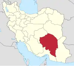
| Country | Iran |
| Province | Kerman |
| County | Qaleh Ganj |
| District | Central |
| Capital | Shamsabad |
| Population (2016)[2] | |
• Total | 15,997 |
| Time zone | UTC+3:30 (IRST) |
Qaleh Ganj Rural District (Persian: دهستان قلعه گنج) is in the Central District of Qaleh Ganj County, Kerman province, Iran.[3] Its capital is the village of Shamsabad.[4] The rural district was previously administered from the city of Qaleh Ganj.[5]
Demographics
Population
At the time of the 2006 National Census, the rural district's population was 13,947 in 2,875 households.[6] There were 16,070 inhabitants in 4,081 households at the following census of 2011.[7] The 2016 census measured the population of the rural district as 15,997 in 4,545 households. The most populous of its 62 villages was Dulab, with 1,253 people.[2]
See also
![]() Iran portal
Iran portal
References
- ↑ OpenStreetMap contributors (7 December 2024). "Shamsabad, Qaleh Ganj Rural District (Qaleh Ganj County)" (Map). OpenStreetMap (in Persian). Retrieved 7 December 2024.
- 1 2 Census of the Islamic Republic of Iran, 1395 (2016): Kerman Province. amar.org.ir (Report) (in Persian). The Statistical Center of Iran. Archived from the original (Excel) on 20 October 2020. Retrieved 19 December 2022.
- ↑ Aref, Mohammad Reza (c. 2023) [Approved 11 May 1384]. Divisional changes and reforms in Kerman province. qavanin.ir (Report) (in Persian). Ministry of the Interior, Defense Political Commission of the Government Board. Proposal 130220/42/4/1; Letter 58538/T26118H. Archived from the original on 5 May 2023. Retrieved 9 July 2023 – via Laws and Regulations Portal of the Islamic Republic of Iran.
- ↑ Mokhbar, Mohammad (26 December 2023) [Approved 24 May 1402]. Letter of approval regarding national divisions in Kerman province. sdil.ac.ir (Report) (in Persian). Ministry of the Interior, Council of Ministers. Notification 90055/T60783. Archived from the original on 30 May 2024. Retrieved 29 August 2024 – via Shahr Danesh Legal Research Institute.
- ↑ Creation and formation of 15 rural districts including villages, fields and places in Kahnuj County under Kerman province. rc.majlis.ir (Report) (in Persian). Ministry of the Interior, Council of Ministers. 5 November 2018 [Approved 18 May 1365]. Proposal 11812; Notification 116180/T856. Archived from the original on 26 October 2019. Retrieved 31 January 2024 – via Islamic Parliament Research Center of the Islamic Republic of Iran.
- ↑ Census of the Islamic Republic of Iran, 1385 (2006): Kerman Province. amar.org.ir (Report) (in Persian). The Statistical Center of Iran. Archived from the original (Excel) on 20 September 2011. Retrieved 25 September 2022.
- ↑ Census of the Islamic Republic of Iran, 1390 (2011): Kerman Province. irandataportal.syr.edu (Report) (in Persian). The Statistical Center of Iran. Archived from the original (Excel) on 29 March 2023. Retrieved 19 December 2022 – via Iran Data Portal, Syracuse University.
Kerman province, Iran | ||
|---|---|---|
| Capital |
|  |
| Counties and cities | ||
| Sights |
| |
| Places |
| |
This article is issued from Wikipedia. The text is licensed under Creative Commons - Attribution - Sharealike. Additional terms may apply for the media files.