Baft County
Baft County
Persian: شهرستان بافت | |
|---|---|
     | |
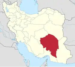
 Location of Baft County in Kerman province (center left, yellow) | |
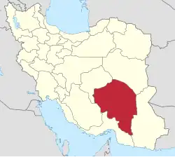
 Location of Kerman province in Iran | |
| Coordinates: 29°10′N 56°30′E / 29.167°N 56.500°E[1] | |
| Country | |
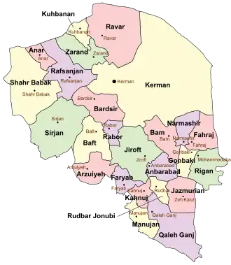
| Province | Kerman |
| Capital | Baft |
| Districts | Central, Khabar |
| Population (2016)[2] | |
• Total | 84,103 |
| Time zone | UTC+3:30 (IRST) |
| Baft County can be found at GEOnet Names Server, at this link, by opening the Advanced Search box, entering "9206651" in the "Unique Feature Id" form, and clicking on "Search Database". | |
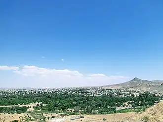
Baft County (Persian: شهرستان بافت) is in Kerman province, Iran. Its capital is the city of Baft.[3]
History
After the 2006 National Census, Arzuiyeh District and Dehsard Rural District were separated from the county in the establishment of Arzuiyeh County,[4] and Rabor District to establish Rabor County.[5] Dashtab and Khabar Rural Districts were separated from the Central District in the formatkon of Khabar District.[4]
Demographics
Population
At the time of the 2006 census, the county's population was 138,847, in 32,262 households.[6] The following census in 2011 counted 75,940 people in 21,195 households.[7] The 2016 census measured the population of the county as 84,103 in 26,543 households.[2]
Administrative divisions
Baft County's population history and administrative structure over three consecutive censuses are shown in the following table.
| Administrative Divisions | 2006[6] | 2011[7] | 2016[2] |
|---|---|---|---|
| Central District | 68,270 | 59,112 | 67,520 |
| Bezenjan RD | 6,279 | 7,834 | 9,959 |
| Dashtab RD | 5,170 | ||
| Dehsard RD[a] | 3,527 | ||
| Fathabad RD | 3,343 | 3,613 | 4,581 |
| Gughar RD | 3,212 | 5,604 | 7,264 |
| Khabar RD | 4,842 | ||
| Kiskan RD | 2,472 | 4,920 | 6,682 |
| Baft (city) | 35,008 | 33,107 | 34,517 |
| Bezenjan (city) | 4,417 | 4,034 | 4,517 |
| Arzuiyeh District[a] | 36,859 | ||
| Arzuiyeh RD | 13,656 | ||
| Soghan RD | 9,749 | ||
| Vakilabad RD | 7,786 | ||
| Arzuiyeh (city) | 5,668 | ||
| Khabar District | 15,902 | 16,012 | |
| Dashtab RD | 9,079 | 9,730 | |
| Khabar RD | 6,823 | 6,282 | |
| Rabor District[b] | 33,718 | ||
| Hanza RD | 6,193 | ||
| Javaran RD | 5,068 | ||
| Rabor RD | 4,562 | ||
| Siyahbanuiyeh RD | 5,509 | ||
| Rabor (city) | 12,386 | ||
| Total | 138,847 | 75,940 | 84,103 |
| RD = Rural District | |||
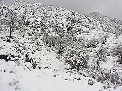
Geography
The elevation of the county is 2,280 to 2,315m. Baft is one of highest counties in Iran and some areas have elevations reaching 2,800m. There are high mountains in Baft, some over 4,300m.
See also
![]() Media related to Baft County at Wikimedia Commons
Media related to Baft County at Wikimedia Commons
![]() Iran portal
Iran portal
Notes
- 1 2 Transferred to Arzuiyeh County[4]
- ↑ Transferred to Rabor County[5]
References
- ↑ OpenStreetMap contributors (3 December 2024). "Baft County" (Map). OpenStreetMap (in Persian). Retrieved 3 December 2024.
- 1 2 3 Census of the Islamic Republic of Iran, 1395 (2016): Kerman Province. amar.org.ir (Report) (in Persian). The Statistical Center of Iran. Archived from the original (Excel) on 20 October 2020. Retrieved 19 December 2022.
- ↑ Habibi, Hassan (c. 2024) [Approved 21 June 1369]. Approval of the organization and chain of citizenship of the elements and units of the national divisions of Kerman province, centered in the city of Kerman. lamtakam.com (Report) (in Persian). Ministry of the Interior, Defense Political Commission of the Government Council. Proposal 3233.1.5.53; Letter 907-93808; Notification 82812/T139K. Archived from the original on 30 January 2024. Retrieved 30 January 2024 – via Lam ta Kam.
- 1 2 3 Rahimi, Mohammad Reza (c. 2023) [Approved 1 December 1389]. Approval letter regarding the national divisions in Baft County under the jurisdiction of Kerman province. qavanin.ir (Report) (in Persian). Ministry of the Interior, Council of Ministers. Proposal 44504/42/4/1. Archived from the original on 29 August 2023. Retrieved 2 December 2024 – via Laws and Regulations Portal of the Islamic Republic of Iran.
- 1 2 Ahmadinejad, Mahmud (c. 2024) [Approved 5 July 1388]. Approval letter regarding divisional reforms and changes in Kerman province. lamtakam.com (Report) (in Persian). Ministry of the Interior, Council of Ministers. Notification 99576/T43154H. Archived from the original on 2 December 2024. Retrieved 2 December 2024 – via Lam ta Kam.
- 1 2 Census of the Islamic Republic of Iran, 1385 (2006): Kerman Province. amar.org.ir (Report) (in Persian). The Statistical Center of Iran. Archived from the original (Excel) on 20 September 2011. Retrieved 25 September 2022.
- 1 2 Census of the Islamic Republic of Iran, 1390 (2011): Kerman Province. irandataportal.syr.edu (Report) (in Persian). The Statistical Center of Iran. Archived from the original (Excel) on 29 March 2023. Retrieved 19 December 2022 – via Iran Data Portal, Syracuse University.
Kerman province, Iran | ||
|---|---|---|
| Capital |
|  |
| Counties and cities | ||
| Sights |
| |
| Places |
| |