Gandoman District
Gandoman District
Persian: بخش گندمان | |
|---|---|
District | |
 Gandoman District | |
| Coordinates: 31°42′06″N 51°11′27″E / 31.70167°N 51.19083°E[1] | |
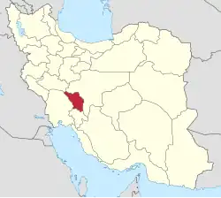
| Country | Iran |
| Province | Chaharmahal and Bakhtiari |
| County | Borujen |
| Capital | Gandoman |
| Population (2016)[2] | |
• Total | 15,803 |
| Time zone | UTC+3:30 (IRST) |
Gandoman District (Persian: بخش گندمان) is in Borujen County, Chaharmahal and Bakhtiari province, Iran. Its capital is the city of Gandoman.[3]
Demographics
Population
At the time of the 2006 National Census, the district's population was 16,203 in 3,964 households.[4] The following census in 2011 counted 15,768 people in 4,368 households.[5] The 2016 census measured the population of the district as 15,803 inhabitants living in 4,694 households.[2]
Administrative divisions
| Administrative Divisions | 2006[4] | 2011[5] | 2016[2] |
|---|---|---|---|
| Dowrahan RD | 5,497 | 5,152 | 4,890 |
| Gandoman RD | 5,128 | 4,855 | 4,622 |
| Gandoman (city) | 5,578 | 5,761 | 6,291 |
| Total | 16,203 | 15,768 | 15,803 |
| RD = Rural District | |||
See also
![]() Iran portal
Iran portal
References
- ↑ OpenStreetMap contributors (28 August 2024). "Gandoman District (Borujen County)" (Map). OpenStreetMap (in Persian). Retrieved 28 August 2024.
- 1 2 3 Census of the Islamic Republic of Iran, 1395 (2016): Chaharmahal and Bakhtiari Province. amar.org.ir (Report) (in Persian). The Statistical Center of Iran. Archived from the original (Excel) on 24 May 2019. Retrieved 19 December 2022.
- ↑ Habibi, Hassan (30 September 2015) [Approved 21 June 1369]. Approval of the organization and chain of citizenship of the elements and units of the national divisions of Chaharmahal and Bakhtiari province, centered in the city of Shahrekord. rc.majlis.ir (Report) (in Persian). Ministry of the Interior, Defense Political Commission of the Government Board. Notification 82826/T124K. Archived from the original on 21 September 2016. Retrieved 2 December 2023 – via Islamic Parliament Research Center.
- 1 2 Census of the Islamic Republic of Iran, 1385 (2006): Chaharmahal and Bakhtiari Province. amar.org.ir (Report) (in Persian). The Statistical Center of Iran. Archived from the original (Excel) on 20 September 2011. Retrieved 25 September 2022.
- 1 2 Census of the Islamic Republic of Iran, 1390 (2011): Chaharmahal and Bakhtiari Province. irandataportal.syr.edu (Report) (in Persian). The Statistical Center of Iran. Archived from the original (Excel) on 16 January 2023. Retrieved 19 December 2022 – via Iran Data Portal, Syracuse University.
Chaharmahal and Bakhtiari province, Iran | |||||||||||||||||||||||
|---|---|---|---|---|---|---|---|---|---|---|---|---|---|---|---|---|---|---|---|---|---|---|---|
| Capital |
|  | |||||||||||||||||||||
| Counties and cities |
| ||||||||||||||||||||||
| Landmarks |
| ||||||||||||||||||||||
| populated places |
| ||||||||||||||||||||||
| Capital |
| ||||||||||||||||||||||||||||
|---|---|---|---|---|---|---|---|---|---|---|---|---|---|---|---|---|---|---|---|---|---|---|---|---|---|---|---|---|---|
| Districts |
| ||||||||||||||||||||||||||||
This article is issued from Wikipedia. The text is licensed under Creative Commons - Attribution - Sharealike. Additional terms may apply for the media files.