Dastana, Chaharmahal and Bakhtiari
Dastana
Persian: دستنا | |
|---|---|
City | |
 Dastana | |
| Coordinates: 32°03′36″N 50°46′15″E / 32.06000°N 50.77083°E[1] | |
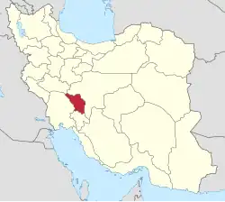
| Country | Iran |
| Province | Chaharmahal and Bakhtiari |
| County | Kiar |
| District | Central |
| Established as a city | 2011[2] |
| Population (2016)[3] | |
• Total | 5,143 |
| Time zone | UTC+3:30 (IRST) |
Dastana (Persian: دستنا)[a] is a city in the Central District of Kiar County, Chaharmahal and Bakhtiari province, Iran.
Demographics
Ethnicity
The city is populated by Lurs.[5]
Population
At the time of the 2006 National Census, Dastana's population was 5,111 in 1,345 households, when it was a village in Kiar-e Gharbi Rural District[b] of the former Kiar District in Shahrekord County.[7] The following census in 2011 counted 5,199 people in 1,577 households,[8] by which time the district had been separated from the county in the establishment of Kiar County. The rural district was transferred to the new Central District,[9] and Dastana was elevated to the status of a city.[2] The 2016 census measured the population of the city as 5,143 people in 1,615 households.[3]
See also
![]() Iran portal
Iran portal
Notes
- ↑ Also romanized as Dastanā; also known as Dasht-e Taneh, Dasht-i-Tana, Dast-e Nā, and Dastnā’[4]
- ↑ Formerly Shalamzar Rural District[6]
References
- ↑ OpenStreetMap contributors (30 August 2024). "Dastana, Kiar County" (Map). OpenStreetMap (in Persian). Retrieved 30 August 2024.
- 1 2 Rahimi, Mohmmad Reza (14 March 2011). "Four new cities in Chaharmahal and Bakhtiari province were added to the national division map; with some changes in the geography of the country". dolat.ir (in Persian). Ministry of the Interior, Political and Defense Commission. Archived from the original on 28 February 2017. Retrieved 2 December 2023 – via Secretariat of the Government Information Council.
- 1 2 Census of the Islamic Republic of Iran, 1395 (2016): Chaharmahal and Bakhtiari Province. amar.org.ir (Report) (in Persian). The Statistical Center of Iran. Archived from the original (Excel) on 24 May 2019. Retrieved 19 December 2022.
- ↑ Dastana can be found at GEOnet Names Server, at this link, by opening the Advanced Search box, entering "-3060072" in the "Unique Feature Id" form, and clicking on "Search Database".
- ↑ "Language distribution: Chahar Mahal va Bakhtiari Province". Iran Atlas. Archived from the original on 4 December 2017. Retrieved 25 March 2021.
- ↑ Habibi, Hassan (30 September 2015) [Approved 26 February 1369]. Approval of reforms in the villages of Chaharmahal and Bakhtiari province. rc.majlis.ir (Report) (in Persian). Ministry of the Interior, Defense Political Commission of the Government Board. Notification 40162/T39K. Archived from the original on 21 September 2016. Retrieved 3 April 2024 – via Islamic Parliament Research Center.
- ↑ Census of the Islamic Republic of Iran, 1385 (2006): Chaharmahal and Bakhtiari Province. amar.org.ir (Report) (in Persian). The Statistical Center of Iran. Archived from the original (Excel) on 20 September 2011. Retrieved 25 September 2022.
- ↑ Census of the Islamic Republic of Iran, 1390 (2011): Chaharmahal and Bakhtiari Province. irandataportal.syr.edu (Report) (in Persian). The Statistical Center of Iran. Archived from the original (Excel) on 16 January 2023. Retrieved 19 December 2022 – via Iran Data Portal, Syracuse University.
- ↑ Davodi, Parviz (c. 2023) [Approved 18 September 1386]. Reforms of country divisions in Chaharmahal and Bakhtiari province. qavanin.ir (Report) (in Persian). Ministry of the Interior, Political-Defense Commission of the Government Board. Notification 58538/T26118AH. Archived from the original on 15 August 2023. Retrieved 6 November 2023 – via Laws and Regulations Portal of the Islamic Republic of Iran.
Chaharmahal and Bakhtiari province, Iran | |||||||||||||||||||||||
|---|---|---|---|---|---|---|---|---|---|---|---|---|---|---|---|---|---|---|---|---|---|---|---|
| Capital |
|  | |||||||||||||||||||||
| Counties and cities |
| ||||||||||||||||||||||
| Landmarks |
| ||||||||||||||||||||||
| populated places |
| ||||||||||||||||||||||
| Capital | |||||||||||||||||||||||
|---|---|---|---|---|---|---|---|---|---|---|---|---|---|---|---|---|---|---|---|---|---|---|---|
| Districts |
| ||||||||||||||||||||||