Tazeh Kand-e Qeshlaq, East Azerbaijan
Tazeh Kand-e Qeshlaq
Persian: تازه كندقشلاق | |
|---|---|
Village | |
 Tazeh Kand-e Qeshlaq | |
| Coordinates: 37°27′40″N 46°16′05″E / 37.46111°N 46.26806°E[1] | |
| Country | Iran |
| Province | East Azerbaijan |
| County | Maragheh |
| District | Central |
| Rural District | Sarajuy-ye Gharbi |
| Area | |
• Total | 0.34 km2 (0.13 sq mi) |
| Population (2016)[2] | |
• Total | 1,112 |
| • Density | 3,300/km2 (8,500/sq mi) |
| Time zone | UTC+3:30 (IRST) |
Tazeh Kand-e Qeshlaq (Persian: تازه كندقشلاق)[a] is a village in Sarajuy-ye Gharbi Rural District of the Central District in Maragheh County, East Azerbaijan province, Iran. The village occupies an area of approximately 0.34 km2.[4]
Demographics
Population
At the time of the 2006 National Census, the village's population was 938 in 213 households.[5] The following census in 2011 counted 1,108 people in 292 households.[6] The 2016 census measured the population of the village as 1,112 people in 315 households.[2]
See also
![]() Iran portal
Iran portal
Notes
References
- ↑ OpenStreetMap contributors (22 March 2025). "Tazeh Kand-e Qeshlaq, Maragheh County" (Map). OpenStreetMap (in Persian). Retrieved 22 March 2025.
- 1 2 Census of the Islamic Republic of Iran, 1395 (2016): East Azerbaijan Province. amar.org.ir (Report) (in Persian). The Statistical Center of Iran. Archived from the original (Excel) on 13 November 2020. Retrieved 19 December 2022.
- ↑ Tazeh Kand-e Qeshlaq can be found at GEOnet Names Server, at this link, by opening the Advanced Search box, entering "-3813633" in the "Unique Feature Id" form, and clicking on "Search Database".
- ↑ "Google Maps". Google Maps.
- ↑ Census of the Islamic Republic of Iran, 1385 (2006): East Azerbaijan Province. amar.org.ir (Report) (in Persian). The Statistical Center of Iran. Archived from the original (Excel) on 20 September 2011. Retrieved 25 September 2022.
- ↑ Census of the Islamic Republic of Iran, 1390 (2011): East Azerbaijan Province. irandataportal.syr.edu (Report) (in Persian). The Statistical Center of Iran. Archived from the original (Excel) on 16 January 2023. Retrieved 19 December 2022 – via Iran Data Portal, Syracuse University.
| Capital | 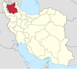 | ||||||||||||||||||||||||||||||||||||||||
|---|---|---|---|---|---|---|---|---|---|---|---|---|---|---|---|---|---|---|---|---|---|---|---|---|---|---|---|---|---|---|---|---|---|---|---|---|---|---|---|---|---|
| Counties and cities |
| ||||||||||||||||||||||||||||||||||||||||
| Landmarks and Sights |
| ||||||||||||||||||||||||||||||||||||||||
| Places |
| ||||||||||||||||||||||||||||||||||||||||
This article is issued from Wikipedia. The text is licensed under Creative Commons - Attribution - Sharealike. Additional terms may apply for the media files.