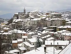
Sante Marie
Sante Marie | |
|---|---|
Comune | |
| Comune di Sante Marie | |
 | |
 Coat of arms | |
Location of Sante Marie | |
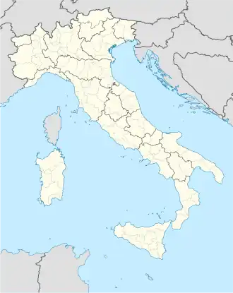 Sante Marie Location of Sante Marie in Italy 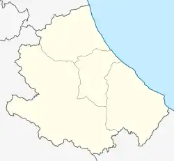 Sante Marie Sante Marie (Abruzzo) | |
| Coordinates: 42°6′16″N 13°12′5″E / 42.10444°N 13.20139°E | |
| Country | Italy |
| Region | Abruzzo |
| Province | L'Aquila (AQ) |
| Frazioni | Castelvecchio, San Giovanni, Santo Stefano, Scanzano, Tubione, Valle dei Varri |
| Government | |
| • Mayor | Lorenzo Berardinetti |
| Area | |
• Total | 40.82 km2 (15.76 sq mi) |
| Elevation | 850 m (2,790 ft) |
| Population (30 November 2017)[2] | |
• Total | 1,156 |
| • Density | 28/km2 (73/sq mi) |
| Demonym | Santemariani |
| Time zone | UTC+1 (CET) |
| • Summer (DST) | UTC+2 (CEST) |
| Postal code | 67067 |
| Dialing code | 0863 |
| Patron saint | San Quirico, Santa Giulitta, San Nicola, Santa Filomena |
| Saint day | 14 July |
| Website | Official website |
Sante Marie is a comune and town in the province of L'Aquila, in the Abruzzo region of central Italy
It is served by a station on the Rome-Pescara railroad.
Climate
| Climate data for Sante Marie-Tubione, elevation 856 m (2,808 ft), (1951–2000) | |||||||||||||
|---|---|---|---|---|---|---|---|---|---|---|---|---|---|
| Month | Jan | Feb | Mar | Apr | May | Jun | Jul | Aug | Sep | Oct | Nov | Dec | Year |
| Mean daily maximum °C (°F) | 6.9 (44.4) |
7.9 (46.2) |
11.2 (52.2) |
14.1 (57.4) |
19.3 (66.7) |
22.9 (73.2) |
26.4 (79.5) |
26.9 (80.4) |
22.3 (72.1) |
17.3 (63.1) |
11.3 (52.3) |
7.3 (45.1) |
16.2 (61.1) |
| Daily mean °C (°F) | 3.0 (37.4) |
3.6 (38.5) |
6.4 (43.5) |
9.0 (48.2) |
13.6 (56.5) |
17.0 (62.6) |
19.7 (67.5) |
20.1 (68.2) |
16.3 (61.3) |
12.0 (53.6) |
7.2 (45.0) |
3.7 (38.7) |
11.0 (51.8) |
| Mean daily minimum °C (°F) | −0.9 (30.4) |
−0.7 (30.7) |
1.6 (34.9) |
4.0 (39.2) |
8.0 (46.4) |
11.2 (52.2) |
13.1 (55.6) |
13.3 (55.9) |
10.4 (50.7) |
6.8 (44.2) |
3.0 (37.4) |
0.1 (32.2) |
5.8 (42.5) |
| Average precipitation mm (inches) | 76.1 (3.00) |
77.8 (3.06) |
71.0 (2.80) |
91.8 (3.61) |
70.8 (2.79) |
54.2 (2.13) |
33.9 (1.33) |
42.1 (1.66) |
68.5 (2.70) |
94.3 (3.71) |
142.5 (5.61) |
127.5 (5.02) |
950.5 (37.42) |
| Average precipitation days | 8.4 | 8.4 | 9.1 | 11.0 | 9.1 | 6.8 | 4.4 | 4.4 | 6.1 | 7.9 | 10.6 | 10.8 | 97 |
| Source: Regione Abruzzo[3] | |||||||||||||
References
- ↑ "Superficie di Comuni Province e Regioni italiane al 9 ottobre 2011". Italian National Institute of Statistics. Retrieved 16 March 2019.
- ↑ All demographics and other statistics from the Italian statistical institute (Istat)
- ↑ "VALORI MEDI CLIMATICI DAL 1951 AL 2000 NELLA REGIONE ABRUZZO" (PDF). Regione Abruzzo. Archived from the original (PDF) on 30 June 2024. Retrieved 30 June 2024.
This article is issued from Wikipedia. The text is licensed under Creative Commons - Attribution - Sharealike. Additional terms may apply for the media files.