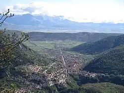
Capistrello
Capistrello | |
|---|---|
Comune | |
| Comune di Capistrello | |
 | |
Location of Capistrello | |
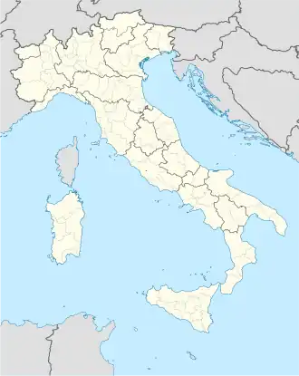 Capistrello Location of Capistrello in Italy 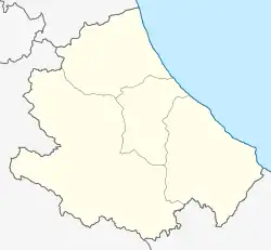 Capistrello Capistrello (Abruzzo) | |
| Coordinates: 41°58′25″N 13°24′0″E / 41.97361°N 13.40000°E | |
| Country | Italy |
| Region | Abruzzo |
| Province | L'Aquila (AQ) |
| Frazioni | Corcumello, Pescocanale |
| Government | |
| • Mayor | Francesco Ciciotti (Noi per Capistrello) |
| Area | |
• Total | 60.97 km2 (23.54 sq mi) |
| Elevation | 734 m (2,408 ft) |
| Population (31 March 2017)[2] | |
• Total | 5,168 |
| • Density | 85/km2 (220/sq mi) |
| Demonym | Capistrellani |
| Time zone | UTC+1 (CET) |
| • Summer (DST) | UTC+2 (CEST) |
| Postal code | 67053 |
| Dialing code | 0863 |
| Patron saint | St. Anthony of Padua |
| Saint day | 13 June |
| Website | Official website |
Capistrello is a comune and town in the province of L'Aquila in the Abruzzo region of central-southern Italy. It is located at the border between the upper Liri River valley and the Marsica. Capistrello borders the following municipalities: Avezzano, Canistro, Castellafiume, Filettino (Frosinone), Luco dei Marsi, Scurcola Marsicana and Tagliacozzo.
Climate
| Climate data for Capistrello, elevation 735 m (2,411 ft), (1951–2000) | |||||||||||||
|---|---|---|---|---|---|---|---|---|---|---|---|---|---|
| Month | Jan | Feb | Mar | Apr | May | Jun | Jul | Aug | Sep | Oct | Nov | Dec | Year |
| Record high °C (°F) | 22.0 (71.6) |
24.0 (75.2) |
27.0 (80.6) |
31.5 (88.7) |
31.0 (87.8) |
35.5 (95.9) |
39.0 (102.2) |
42.0 (107.6) |
35.0 (95.0) |
31.5 (88.7) |
25.6 (78.1) |
20.0 (68.0) |
42.0 (107.6) |
| Mean daily maximum °C (°F) | 6.5 (43.7) |
8.1 (46.6) |
11.0 (51.8) |
14.1 (57.4) |
19.4 (66.9) |
23.8 (74.8) |
27.5 (81.5) |
27.4 (81.3) |
23.2 (73.8) |
17.4 (63.3) |
11.6 (52.9) |
7.3 (45.1) |
16.4 (61.6) |
| Daily mean °C (°F) | 2.3 (36.1) |
3.6 (38.5) |
5.9 (42.6) |
8.7 (47.7) |
13.2 (55.8) |
17.1 (62.8) |
20.0 (68.0) |
20.0 (68.0) |
16.5 (61.7) |
11.6 (52.9) |
6.9 (44.4) |
3.5 (38.3) |
10.8 (51.4) |
| Mean daily minimum °C (°F) | −2.0 (28.4) |
−1.0 (30.2) |
0.8 (33.4) |
3.2 (37.8) |
7.0 (44.6) |
10.4 (50.7) |
12.4 (54.3) |
12.7 (54.9) |
9.9 (49.8) |
5.8 (42.4) |
2.3 (36.1) |
−0.4 (31.3) |
5.1 (41.2) |
| Record low °C (°F) | −20.0 (−4.0) |
−15.0 (5.0) |
−15.0 (5.0) |
−8.0 (17.6) |
−4.5 (23.9) |
1.0 (33.8) |
3.0 (37.4) |
2.5 (36.5) |
0.0 (32.0) |
−7.0 (19.4) |
−14.5 (5.9) |
−15.0 (5.0) |
−20.0 (−4.0) |
| Average precipitation mm (inches) | 107.4 (4.23) |
108.6 (4.28) |
86.5 (3.41) |
95.1 (3.74) |
68.1 (2.68) |
47.6 (1.87) |
29.9 (1.18) |
42.2 (1.66) |
68.7 (2.70) |
124.6 (4.91) |
169.2 (6.66) |
143.4 (5.65) |
1,091.3 (42.97) |
| Average precipitation days | 9.0 | 9.2 | 9.1 | 9.7 | 8.4 | 6.3 | 4.1 | 4.8 | 6.1 | 8.1 | 10.3 | 9.5 | 94.6 |
| Source: Regione Abruzzo[3] | |||||||||||||
See also
- Capistrello massacre
- Tunnels of Claudius
References
- ↑ "Superficie di Comuni Province e Regioni italiane al 9 ottobre 2011". Italian National Institute of Statistics. Retrieved 16 March 2019.
- ↑ All demographics and other statistics from the Italian statistical institute (Istat)
- ↑ "VALORI MEDI CLIMATICI DAL 1951 AL 2000 NELLA REGIONE ABRUZZO" (PDF). Regione Abruzzo. Archived from the original (PDF) on 30 June 2024. Retrieved 30 June 2024.
Cunicoli di Claudio
This article is issued from Wikipedia. The text is licensed under Creative Commons - Attribution - Sharealike. Additional terms may apply for the media files.