Qareh Tappeh, Shabestar
Qareh Tappeh
Persian: قره تپه | |
|---|---|
Village | |
 Qareh Tappeh | |
| Coordinates: 38°16′15″N 45°21′28″E / 38.27083°N 45.35778°E[1] | |
| Country | Iran |
| Province | East Azerbaijan |
| County | Shabestar |
| District | Tasuj |
| Rural District | Guney-ye Gharbi |
| Population (2016)[2] | |
• Total | 1,634 |
| Time zone | UTC+3:30 (IRST) |
Qareh Tappeh (Persian: قره تپه)[a] is a village in Guney-ye Gharbi Rural District of Tasuj District[b] in Shabestar County, East Azerbaijan province, Iran.
Demographics
Population
At the time of the 2006 National Census, the village's population was 1,768 in 496 households.[5] The following census in 2011 counted 1,667 people in 536 households.[6] The 2016 census measured the population of the village as 1,634 people in 580 households.[2]
See also
![]() Iran portal
Iran portal
Notes
- ↑ Also known as Lak, Lāk-e ‘Olyā, Lāk-e Soflá, Līyek, Qara Tepe, Qareh Tappeh ‘Olya va Soflā, Qareh Tappeh-ye Bālā, Qareh Tappeh-ye ‘Olyā va Soflá, and Qareh Tappeh-ye Pā’īn[3]
- ↑ Formerly Anzab District[4]
References
- ↑ OpenStreetMap contributors (1 April 2025). "Qareh Tappeh, Shabestar County" (Map). OpenStreetMap (in Persian). Retrieved 1 April 2025.
- 1 2 Census of the Islamic Republic of Iran, 1395 (2016): East Azerbaijan Province. amar.org.ir (Report) (in Persian). The Statistical Center of Iran. Archived from the original (Excel) on 13 November 2020. Retrieved 19 December 2022.
- ↑ Qareh Tappeh can be found at GEOnet Names Server, at this link, by opening the Advanced Search box, entering "-3079785" in the "Unique Feature Id" form, and clicking on "Search Database".
- ↑ Davodi, Parviz (c. 2014) [Approved 13 May 1387]. Approval letter regarding changing the name of Anzab District from Shabestar County in East Azerbaijan province to Tasuj District. rc.majlis.ir (Report) (in Persian). Ministry of the Interior, Political-Defense Commission. Proposal 63375/42/4/1. Archived from the original on 27 April 2014. Retrieved 6 December 2023 – via Research Center of the System of Laws of the Islamic Council of the Farabi Library of Mobile Users.
- ↑ Census of the Islamic Republic of Iran, 1385 (2006): East Azerbaijan Province. amar.org.ir (Report) (in Persian). The Statistical Center of Iran. Archived from the original (Excel) on 20 September 2011. Retrieved 25 September 2022.
- ↑ Census of the Islamic Republic of Iran, 1390 (2011): East Azerbaijan Province. irandataportal.syr.edu (Report) (in Persian). The Statistical Center of Iran. Archived from the original (Excel) on 16 January 2023. Retrieved 19 December 2022 – via Iran Data Portal, Syracuse University.
| Capital | 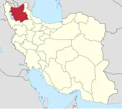 | ||||||||||||||||||||||||||||||||||||||||
|---|---|---|---|---|---|---|---|---|---|---|---|---|---|---|---|---|---|---|---|---|---|---|---|---|---|---|---|---|---|---|---|---|---|---|---|---|---|---|---|---|---|
| Counties and cities |
| ||||||||||||||||||||||||||||||||||||||||
| Landmarks and Sights |
| ||||||||||||||||||||||||||||||||||||||||
| Places |
| ||||||||||||||||||||||||||||||||||||||||
| Capital |
| ||||||||||||||||||||||||||||||||||
|---|---|---|---|---|---|---|---|---|---|---|---|---|---|---|---|---|---|---|---|---|---|---|---|---|---|---|---|---|---|---|---|---|---|---|---|
| Districts |
| ||||||||||||||||||||||||||||||||||
This article is issued from Wikipedia. The text is licensed under Creative Commons - Attribution - Sharealike. Additional terms may apply for the media files.