Mahmudabad County
Mahmudabad County
Persian: شهرستان محمودآباد | |
|---|---|
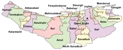 Location of Mahmudabad County in Mazandaran province (top center, yellow) | |
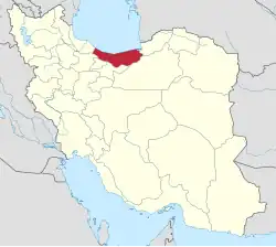 Location of Mazandaran province in Iran | |
| Coordinates: 36°36′N 52°19′E / 36.600°N 52.317°E[1] | |
| Country | Iran |
| Province | Mazandaran |
| Capital | Mahmudabad |
| Districts | Central, Sorkhrud |
| Area | |
• Total | 262.80 km2 (101.47 sq mi) |
| Population (2016)[3] | |
• Total | 98,407 |
| • Density | 370/km2 (970/sq mi) |
| Time zone | UTC+3:30 (IRST) |
| Mahmudabad County can be found at GEOnet Names Server, at this link, by opening the Advanced Search box, entering "9207264" in the "Unique Feature Id" form, and clicking on "Search Database". | |
Mahmudabad County (Persian: شهرستان محمودآباد) is in Mazandaran province, Iran. Its capital is the city of Mahmudabad.[4]
Demographics
Population
At the time of the 2006 National Census, the county's population was 90,054 in 24,135 households.[5] The following census in 2011 counted 96,019 people in 28,957 households.[6] The 2016 census measured the population of the county as 98,407 in 32,810 households.[3]
Administrative divisions
Mahmudabad County's population history and administrative structure over three consecutive censuses are shown in the following table.
| Administrative Divisions | 2006[5] | 2011[6] | 2016[3] |
|---|---|---|---|
| Central District | 59,397 | 64,783 | 65,767 |
| Ahlamerestaq-e Jonubi RD[a] | 15,089 | 15,835 | 15,531 |
| Ahlamerestaq-e Shomali RD | 9,927 | 10,269 | 10,363 |
| Harazpey-ye Gharbi RD | 6,820 | 6,908 | 8,029 |
| Mahmudabad (city) | 27,561 | 31,771 | 31,844 |
| Sorkhrud District | 30,657 | 31,236 | 32,640 |
| Dabuy-ye Shomali RD | 7,745 | 8,110 | 9,015 |
| Harazpey-ye Shomali RD | 16,343 | 17,205 | 16,926 |
| Sorkhrud (city) | 6,569 | 5,921 | 6,699 |
| Total | 90,054 | 96,019 | 98,407 |
| RD = Rural District | |||
See also
![]() Media related to Mahmudabad County at Wikimedia Commons
Media related to Mahmudabad County at Wikimedia Commons
Notes
- ↑ Formerly Ahlamerestaq Rural District[4]
References
- ↑ OpenStreetMap contributors (22 October 2024). "Mahmudabad County" (Map). OpenStreetMap (in Persian). Retrieved 22 October 2024.
- ↑ Management and Planning Organization of Mazandaran, 2006
- 1 2 3 Census of the Islamic Republic of Iran, 1395 (2016): Mazandaran Province. amar.org.ir (Report) (in Persian). The Statistical Center of Iran. Archived from the original (Excel) on 7 October 2021. Retrieved 19 December 2022.
- 1 2 Habibi, Hassan (c. 2024) [Approved 5 June 1374]. Divisional changes in Hezar District of Amol County in Mazandaran province. lamtakam.com (Report) (in Persian). Ministry of the Interior, Council of Ministers. Proposal 1.4.42.5268; Letter 93808-907. Archived from the original on 15 January 2024. Retrieved 15 January 2024 – via Lam ta Kam.
- 1 2 Census of the Islamic Republic of Iran, 1385 (2006): Mazandaran Province. amar.org.ir (Report) (in Persian). The Statistical Center of Iran. Archived from the original (Excel) on 20 September 2011. Retrieved 25 September 2022.
- 1 2 Census of the Islamic Republic of Iran, 1390 (2011): Mazandaran Province. irandataportal.syr.edu (Report) (in Persian). The Statistical Center of Iran. Archived from the original (Excel) on 19 January 2023. Retrieved 19 December 2022 – via Iran Data Portal, Syracuse University.
| Capital |
| ||||||||||||||||||
|---|---|---|---|---|---|---|---|---|---|---|---|---|---|---|---|---|---|---|---|
| Districts |
| ||||||||||||||||||
This article is issued from Wikipedia. The text is licensed under Creative Commons - Attribution - Sharealike. Additional terms may apply for the media files.