Jalayer, Ardabil
Jalayer
Persian: جلاير | |
|---|---|
Village | |
 Jalayer | |
| Coordinates: 38°33′23″N 47°45′43″E / 38.55639°N 47.76194°E[1] | |
| Country | Iran |
| Province | Ardabil |
| County | Meshgin Shahr |
| District | Meshgin-e Sharqi |
| Rural District | Lahrud |
| Population (2016)[2] | |
• Total | 528 |
| Time zone | UTC+3:30 (IRST) |
Jalayer (Persian: جلاير)[a] is a village in Lahrud Rural District of Meshgin-e Sharqi District in Meshgin Shahr County, Ardabil province, Iran.
Demographics
Population
At the time of the 2006 National Census, the village's population was 714 in 165 households.[4] The following census in 2011 counted 575 people in 165 households.[5] The 2016 census measured the population of the village as 528 people in 166 households.[2]
See also
![]() Iran portal
Iran portal
Notes
References
- ↑ OpenStreetMap contributors (25 February 2025). "Jalayer, Meshgin Shahr County" (Map). OpenStreetMap (in Persian). Retrieved 25 February 2025.
- 1 2 Census of the Islamic Republic of Iran, 1395 (2016): Ardabil Province. amar.org.ir (Report) (in Persian). The Statistical Center of Iran. Archived from the original (Excel) on 22 March 2019. Retrieved 19 December 2022.
- ↑ Jalayer can be found at GEOnet Names Server, at this link, by opening the Advanced Search box, entering "-3776492" in the "Unique Feature Id" form, and clicking on "Search Database".
- ↑ Census of the Islamic Republic of Iran, 1385 (2006): Ardabil Province. amar.org.ir (Report) (in Persian). The Statistical Center of Iran. Archived from the original (Excel) on 20 September 2011. Retrieved 25 September 2022.
- ↑ Census of the Islamic Republic of Iran, 1390 (2011): Ardabil Province. irandataportal.syr.edu (Report) (in Persian). The Statistical Center of Iran. Archived from the original (Excel) on 15 January 2023. Retrieved 19 December 2022 – via Iran Data Portal, Syracuse University.
| Capital | 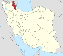 | ||||||||||||||||||||||
|---|---|---|---|---|---|---|---|---|---|---|---|---|---|---|---|---|---|---|---|---|---|---|---|
| Counties and cities |
| ||||||||||||||||||||||
| Landmarks |
| ||||||||||||||||||||||
| Places |
| ||||||||||||||||||||||
This article is issued from Wikipedia. The text is licensed under Creative Commons - Attribution - Sharealike. Additional terms may apply for the media files.