Guangfu, Hualien
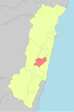
Guangfu Township
光復鄉 Fata'an (馬太鞍) | |
|---|---|
 | |
 | |
| Coordinates: 23°38′6.23″N 121°25′21.94″E / 23.6350639°N 121.4227611°E | |
| Country | Taiwan |
| Region | Eastern Taiwan |
| Government | |
| • Type | Township |
| Area | |
• Total | 157.1100 km2 (60.6605 sq mi) |
| Population (February 2023) | |
• Total | 11,975 |
| Time zone | UTC+8 (CST) |
| Post code | 976 |
| Subdivision | 14 Villages |
| Website | www.guangfu.gov.tw (in Chinese) |
Guangfu Township (Chinese: 光復鄉; pinyin: Guāngfù Xiāng) is a rural township located in mid Huatung Valley between Central Mountain Range and coastal Range of Hualien County, Taiwan. The indigenous Amis people make up about half of the population. The main economical activity is agriculture.
Geography
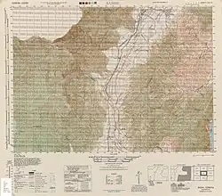
Map including Guangfu area (1944)
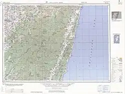
Map including Guangfu area (1951)
The township is located at the Huatung Valley.
Administrative divisions
The township has 14 villages with a population of 11,975 inhabitants. Dahua, Daan, Daping, Dama, Datong, Tungfu, Xifu, Nanfu, Beifu, Dajin, Daquan, Daxing, Dafu and Dafeng Village.
Tourist attractions
%252C_Hualien_Sugar_Factory%252C_Guangfu_Township%252C_Hualien_County_(Taiwan).jpg)
Deputy Factory Manager's Quarters, Hualien Sugar Factory
- Bao'an Temple
- Dafong Ecological Park
- Danongdafu Forest Park
- Daxing Waterfall Memorial Park
- Hualien Sugar Factory
- Mataian Culture Street
- Mataian Humanities Studio
- Matai'an Wetland Ecological Park
- Mudflow Memorial Park
- Tabalong aboriginal culture[1]
Transportation

Guangfu Station
- Taiwan Railways Administration Guangfu and Dafu Station (Taitung line)
- Provincial Highway No.9 (Hualien-Taitung Provincial Highway)
- Provincial Highway No.11A (Guangfu-Fengbin)
- County Road No.193
Notable natives
- Lin Chiung-ying, football and futsal player
References
- ↑ "East Rift Valley National Scenic Area Administration::Touring the Rift Valley-City and Countryside Travel". Archived from the original on 2014-05-13. Retrieved 2014-05-10.
External links
Wikimedia Commons has media related to Guangfu Township, Hualien County.
- Guangfu Township Administration Office
 Guangfu travel guide from Wikivoyage
Cities and townships of Hualien County | ||
|---|---|---|
County seat: Hualien City | ||
| Cities |
| 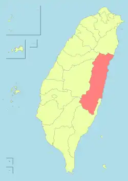 |
| Urban townships | ||
| Rural townships | ||
| Mountain indigenous townships | ||
| Highland indigenous Townships and Districts |
|  | ||||||||||||||||||||||||
|---|---|---|---|---|---|---|---|---|---|---|---|---|---|---|---|---|---|---|---|---|---|---|---|---|---|---|
| Plains indigenous Townships and County-Administered Cities |
| |||||||||||||||||||||||||
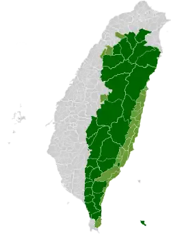
Note: On the map, "Mountain Indigenous Areas" are in dark green and "Plains Indigenous Areas" are in light green. | ||||||||||||||||||||||||||
This article is issued from Wikipedia. The text is licensed under Creative Commons - Attribution - Sharealike. Additional terms may apply for the media files.