Eastern Statistical Region
Eastern Statistical Region
Источен Регион | |
|---|---|
 Mountains on the Border with Bulgaria | |
|
Flag | |
 | |
| Country | |
| Area | |
• Total | 3,539 km2 (1,366 sq mi) |
| Population (2021)[1] | |
• Total | 150,234 |
| • Density | 42/km2 (110/sq mi) |
| HDI (2017) | 0.741[2] high · 5th of 8 |
The Eastern Statistical Region (Macedonian: Источен Регион, romanized: Istočen Region) is one of eight statistical regions of North Macedonia. Eastern, located in the eastern part of the country, borders Bulgaria. Internally, it borders the Vardar, Skopje, Northeastern, and Southeastern statistical regions.
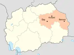
Municipalities

The municipalities of the region
The Eastern Statistical Region is divided into 11 municipalities:
 Berovo Municipality
 Češinovo-Obleševo
- Delčevo Municipality
- Karbinci Municipality
- Kočani Municipality
- Makedonska Kamenica Municipality
- Pehčevo Municipality
- Probištip Municipality
- Štip Municipality
- Vinica
- Zrnovci Municipality
Demographics
Population
The current population of the Eastern Statistical Region is 150,234 citizens or 8.2% of the total population of the Republic of North Macedonia, according to the last population census in 2021.
| Census Year | Population | Change |
|---|---|---|
| 1994 | 180,039 | N/A |
| 2002 | 181,858 | +1.01% |
| 2021 | 150,234 | -13.38% |
Ethnicities
The largest ethnic group in the region are the Macedonians.
| 2002 | 2021 | |||
| Number | % | Number | % | |
| TOTAL | 181,858 | 100 | 150,234 | 100 |
| Macedonians | 168,046 | 92.4 | 126,553 | 84.24 |
| Roma | 6,929 | 3.81 | 6,126 | 4.08 |
| Turks | 3,163 | 1.74 | 2,958 | 1.97 |
| Vlachs | 2,535 | 1.39 | 1,892 | 1.26 |
| Serbs | 594 | 0.33 | 330 | 0.22 |
| Albanians | 20 | 0.01 | 101 | 0.07 |
| Bosniaks | 25 | 0.02 | 45 | 0.02 |
| Others / Undeclared / Unknown | 546 | 0.3 | 795 | 0.53 |
| Persons for whom data are taken from administrative sources | 11,434 | 7.61 | ||
References
- ↑ "North Macedonia: Statistical Regions & Major Settlements - Population Statistics, Maps, Charts, Weather and Web Information".
- ↑ "Sub-national HDI - Area Database - Global Data Lab". hdi.globaldatalab.org. Retrieved 2018-09-13.
External links
Wikimedia Commons has media related to Eastern Statistical Region.
 Eastern Macedonia travel guide from Wikivoyage
This article is issued from Wikipedia. The text is licensed under Creative Commons - Attribution - Sharealike. Additional terms may apply for the media files.