Cheraghabad Rural District
Cheraghabad Rural District
Persian: دهستان چراغ آباد | |
|---|---|
Rural District | |
 Cheraghabad Rural District | |
| Coordinates: 27°07′35″N 57°27′54″E / 27.12639°N 57.46500°E[1] | |
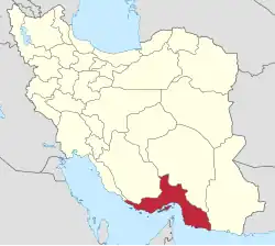
| Country | Iran |
| Province | Hormozgan |
| County | Minab |
| District | Tukahur |
| Capital | Hasht Bandi |
| Population (2016)[2] | |
• Total | 15,241 |
| Time zone | UTC+3:30 (IRST) |
Cheraghabad Rural District (Persian: دهستان چراغ آباد) is in Tukahur District of Minab County, Hormozgan province, Iran. It is administered from the city of Hasht Bandi.[3]
Demographics
Population
At the time of the 2006 National Census, the rural district's population was 18,281 in 3,831 households.[4] There were 13,619 inhabitants in 3,214 households at the following census of 2011.[5] The 2016 census measured the population of the rural district as 15,241 in 4,001 households. The most populous of its 25 villages was Mojtame-ye Emam, with 2,335 people.[2]
See also
![]() Iran portal
Iran portal
References
- ↑ OpenStreetMap contributors (19 November 2024). "Cheraghabad Rural District (Minab County)" (Map). OpenStreetMap (in Persian). Retrieved 19 November 2024.
- 1 2 Census of the Islamic Republic of Iran, 1395 (2016): Hormozgan Province. amar.org.ir (Report) (in Persian). The Statistical Center of Iran. Archived from the original (Excel) on 5 May 2022. Retrieved 19 December 2022.
- ↑ Aref, Mohammad Reza (c. 2022) [Approved 10 May 1384]. Divisional changes and reforms in Hormozgan province. qavanin.ir (Report) (in Persian). Ministry of the Interior, Defense Political Commission of the Government Board. Proposal 2157/42/1/4; Letter 58538/T26118H. Archived from the original on 26 April 2022. Retrieved 9 February 2024 – via Laws and Regulations Portal of the Islamic Republic of Iran.
- ↑ Census of the Islamic Republic of Iran, 1385 (2006): Hormozgan Province. amar.org.ir (Report) (in Persian). The Statistical Center of Iran. Archived from the original (Excel) on 20 September 2011. Retrieved 25 September 2022.
- ↑ Census of the Islamic Republic of Iran, 1390 (2011): Hormozgan Province. irandataportal.syr.edu (Report) (in Persian). The Statistical Center of Iran. Archived from the original (Excel) on 17 January 2023. Retrieved 19 December 2022 – via Iran Data Portal, Syracuse University.
Hormozgan province, Iran | |||||||||||||||||||||||||
|---|---|---|---|---|---|---|---|---|---|---|---|---|---|---|---|---|---|---|---|---|---|---|---|---|---|
| Capital |
|  | |||||||||||||||||||||||
| Counties and cities |
| ||||||||||||||||||||||||
| Sights |
| ||||||||||||||||||||||||
| populated places |
| ||||||||||||||||||||||||
| See also |
| ||||||||||||||||||||||||
This article is issued from Wikipedia. The text is licensed under Creative Commons - Attribution - Sharealike. Additional terms may apply for the media files.