Zardalan Rural District
Zardalan Rural District
Persian: دهستان زردلان | |
|---|---|
Rural District | |
 Zardalan Rural District 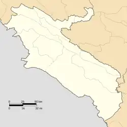 Zardalan Rural District | |
| Coordinates: 33°49′30″N 47°25′00″E / 33.82500°N 47.41667°E[1] | |
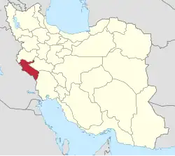
| Country | Iran |
| Province | Ilam |
| County | Holeylan |
| District | Jazman |
| Capital | Piyazabad |
| Population (2016)[2] | |
• Total | 2,514 |
| Time zone | UTC+3:30 (IRST) |
Zardalan Rural District (Persian: دهستان زردلان) is in Jazman District of Holeylan County, Ilam province, Iran.[3] Its capital is the village of Piyazabad.[4]
Demographics
Population
At the time of the 2006 National Census, the rural district's population (as a part of the former Holeylan District of Chardavol County[a]) was 2,518 in 512 households.[6] There were 2,527 inhabitants in 590 households at the following census of 2011.[7] The 2016 census measured the population of the rural district as 2,514 in 650 households. The most populous of its 31 villages was Piyazabad, with 389 people.[2]
In 2018, the district was separated from the county in the establishment of Holeylan County, and the rural district was transferred to the new Jazman District.[3]
See also
![]() Iran portal
Iran portal
Notes
- ↑ Formerly Shirvan and Chardavol County[5]
References
- ↑ OpenStreetMap contributors (23 November 2024). "Zardalan Rural District (Holeylan County)" (Map). OpenStreetMap (in Persian). Retrieved 23 November 2024.
- 1 2 Census of the Islamic Republic of Iran, 1395 (2016): Ilam Province. amar.org.ir (Report) (in Persian). The Statistical Center of Iran. Archived from the original (Excel) on 1 November 2020. Retrieved 19 December 2022.
- 1 2 Janhangiri, Ishaq (26 January 2018) [Approved 10 August 2018]. Approval letter regarding the national divisions of Ilam province. rc.majlis.ir (Report) (in Persian). Ministry of the Interior, Council of Ministers. Proposal 77496; Notification 131622/T56784H. Archived from the original on 16 January 2020. Retrieved 3 June 2023 – via Islamic Parliament Research Center of the Islamic Republic of Iran.
- ↑ Habibi, Hassan (c. 2018) [Approved 12 December 1371]. Creation of 48 rural districts in several rural areas of the country. qavanin.ir (Report) (in Persian). Ministry of the Interior, Political-Defense Commission of the Government Council. Resolution 93808/T907. Archived from the original on 28 November 2018. Retrieved 2 January 2024 – via Laws and Regulations Portal of the Islamic Republic of Iran.
- ↑ Rahimi, Mohammad Reza (c. 2016) [Approved 29 March 1392]. Approval letter regarding national divisions in Ilam province. rc.majlis.ir (Report) (in Persian). Ministry of the Interior, Board of Ministers. Proposal 81072/42/1/4/1; Notification 83592/T48494H. Archived from the original on 19 September 2016. Retrieved 3 June 2023 – via Islamic Parliament Research Center.
- ↑ Census of the Islamic Republic of Iran, 1385 (2006): Ilam Province. amar.org.ir (Report) (in Persian). The Statistical Center of Iran. Archived from the original (Excel) on 20 September 2011. Retrieved 25 September 2022.
- ↑ Census of the Islamic Republic of Iran, 1390 (2011): Ilam Province. irandataportal.syr.edu (Report) (in Persian). The Statistical Center of Iran. Archived from the original (Excel) on 17 January 2023. Retrieved 19 December 2022 – via Iran Data Portal, Syracuse University.
Ilam province, Iran | ||||||||||||||||||||||||
|---|---|---|---|---|---|---|---|---|---|---|---|---|---|---|---|---|---|---|---|---|---|---|---|---|
Capital: Ilam | ||||||||||||||||||||||||
| Counties and cities |
|  | ||||||||||||||||||||||
| Sights |
| |||||||||||||||||||||||
| Populated places |
| |||||||||||||||||||||||
This article is issued from Wikipedia. The text is licensed under Creative Commons - Attribution - Sharealike. Additional terms may apply for the media files.