Shahrak-e Vali-ye Asr, Ilam
Shahrak-e Vali-ye Asr
Persian: شهرك ولي عصر | |
|---|---|
Village | |
 Shahrak-e Vali-ye Asr 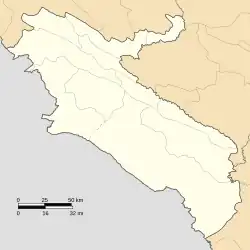 Shahrak-e Vali-ye Asr | |
| Coordinates: 32°19′18″N 47°54′37″E / 32.32167°N 47.91028°E[1] | |
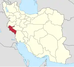
| Country | Iran |
| Province | Ilam |
| County | Dehloran |
| District | Dasht-e Abbas |
| Rural District | Dasht-e Abbas |
| Population (2016)[2] | |
• Total | 942 |
| Time zone | UTC+3:30 (IRST) |
Shahrak-e Vali-ye Asr (Persian: شهرك ولي عصر)[a] is a village in Dasht-e Abbas Rural District of Dasht-e Abbas District, Dehloran County, Ilam province, Iran.
Demographics
Language
The village is populated by Arabs.[4]
Population
At the time of the 2006 National Census, the village's population was 842 in 127 households, when it was in Musiyan District.[5] The following census in 2011 counted 943 people in 195 households.[6] The 2016 census measured the population of the village as 942 people in 216 households. It was the most populous village in its rural district.[2]
In 2017, the rural district was separated from the district in the formation of Dasht-e Abbas District.[7]
See also
![]() Iran portal
Iran portal
Notes
References
- ↑ OpenStreetMap contributors (22 November 2024). "Shahrak-e Vali-ye Asr, Dehloran County" (Map). OpenStreetMap (in Persian). Retrieved 22 November 2024.
- 1 2 Census of the Islamic Republic of Iran, 1395 (2016): Ilam Province. amar.org.ir (Report) (in Persian). The Statistical Center of Iran. Archived from the original (Excel) on 1 November 2020. Retrieved 19 December 2022.
- ↑ Shahrak-e Vali-ye Asr can be found at GEOnet Names Server, at this link, by opening the Advanced Search box, entering "-3086849" in the "Unique Feature Id" form, and clicking on "Search Database".
- ↑ "Language distribution: Ilam Province". Iran Atlas. Archived from the original on 14 January 2021. Retrieved 24 March 2021.
- ↑ Census of the Islamic Republic of Iran, 1385 (2006): Ilam Province. amar.org.ir (Report) (in Persian). The Statistical Center of Iran. Archived from the original (Excel) on 20 September 2011. Retrieved 25 September 2022.
- ↑ Census of the Islamic Republic of Iran, 1390 (2011): Ilam Province. irandataportal.syr.edu (Report) (in Persian). The Statistical Center of Iran. Archived from the original (Excel) on 17 January 2023. Retrieved 19 December 2022 – via Iran Data Portal, Syracuse University.
- ↑ Jahangiri, Ishaq (22 March 2017) [Approved 5 December 1997]. Approval letter regarding national divisions in Dehloran County, Ilam province. rc.majlis.ir (Report) (in Persian). Ministry of the Interior, Council of Ministers. Proposal 38665; Notification 164929/T55512H. Archived from the original on 13 March 2019. Retrieved 5 June 2023 – via Islamic Parliament Research Center of the Islamic Republic of Iran.
Ilam province, Iran | ||||||||||||||||||||||||
|---|---|---|---|---|---|---|---|---|---|---|---|---|---|---|---|---|---|---|---|---|---|---|---|---|
Capital: Ilam | ||||||||||||||||||||||||
| Counties and cities |
|  | ||||||||||||||||||||||
| Sights |
| |||||||||||||||||||||||
| Populated places |
| |||||||||||||||||||||||
| Capital | |||||||||||||||||||||||||
|---|---|---|---|---|---|---|---|---|---|---|---|---|---|---|---|---|---|---|---|---|---|---|---|---|---|
| Districts |
| ||||||||||||||||||||||||
This article is issued from Wikipedia. The text is licensed under Creative Commons - Attribution - Sharealike. Additional terms may apply for the media files.