Saluda Mountains
| Saluda Mountains | |
|---|---|
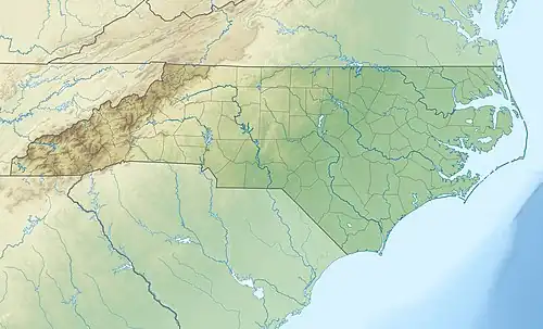 Saluda Mountains Located along the North and South Carolina border 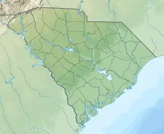 Saluda Mountains Saluda Mountains (South Carolina) 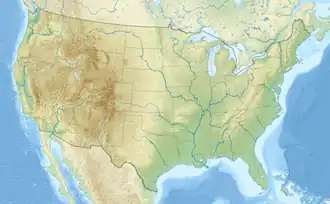 Saluda Mountains Saluda Mountains (the United States) | |
| Highest point | |
| Peak | Grassy Top Mountain |
| Elevation | 3,258 ft (993 m) |
| Coordinates | 35°09′22″N 82°31′36″W / 35.15611°N 82.52667°W |
| Geography | |
| Country | |
| States | North Carolina and South Carolina |
| Parent range | Blue Ridge Mountains |
The Saluda Mountains are a mountain range that straddles along the North Carolina and South Carolina border, in the southeastern United States. They are part of the Blue Ridge Province of the Southern Appalachian Mountains.[1]
Geography
The range begins at Standingstone Mountain, near Caesars Head State Park, and go northeasterly to Blakes Peak, near Saluda, North Carolina. Straddling the North and South Carolina state line, it is flanked by the Green and Saluda rivers.
Notable summits
Listed are the ten highest summits in the range.
| Mountain | Elevation | Coordinates | General area | Named after |
|---|---|---|---|---|
| Grassy Top Mountain | 3,258 feet (993 m) | 35°09′21″N 82°31′36″W / 35.15583°N 82.52667°W | Greenville County, SC–Henderson County, NC | |
| Standingstone Mountain | 3,209 feet (978 m) | 35°08′39″N 82°34′22″W / 35.14417°N 82.57278°W | Greenville County, SC–Henderson County, NC | |
| Hogback Mountain | 3,130 feet (950 m) | 35°09′57″N 82°30′15″W / 35.16583°N 82.50417°W | Greenville County, SC–Henderson County, NC | |
| Big Top | 3,048 feet (929 m) | 35°09′57″N 82°29′39″W / 35.16583°N 82.49417°W | Greenville County, SC–Henderson County, NC | |
| Mackerel Mountain | 3,038 feet (926 m) | 35°10′28″N 82°29′11″W / 35.17444°N 82.48639°W | Greenville County, SC–Henderson County, NC | |
| Corbin Mountain | 3,031 feet (924 m) | 35°10′05″N 82°26′05″W / 35.16806°N 82.43472°W | Greenville County, SC–Henderson County, NC | |
| Pruett Mountain | 3,022 feet (921 m) | 35°10′03″N 82°26′04″W / 35.16750°N 82.43444°W | Greenville County, SC | |
| McCarrol Mountain | 2,982 feet (909 m) | 35°10′27″N 82°28′27″W / 35.17417°N 82.47417°W | Greenville County, SC–Henderson County, NC | |
| Frank Mountain | 2,933 feet (894 m) | 35°10′40″N 82°27′37″W / 35.17778°N 82.46028°W | Greenville County, SC–Henderson County, NC | |
| Long Mountain | 2,923 feet (891 m) | 35°11′30″N 82°28′05″W / 35.19167°N 82.46806°W | Henderson County, NC |
References
- ↑ "Saluda Mountains". Geographic Names Information System. United States Geological Survey, United States Department of the Interior. Retrieved July 20, 2014.
External links
This article is issued from Wikipedia. The text is licensed under Creative Commons - Attribution - Sharealike. Additional terms may apply for the media files.