Refugium Range
| Refugium Range | |
|---|---|
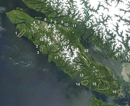 The Refugium Range is marked 1 on map | |
| Highest point | |
| Coordinates | 50°09′00″N 127°46′00″W / 50.15000°N 127.76667°W |
| Geography | |
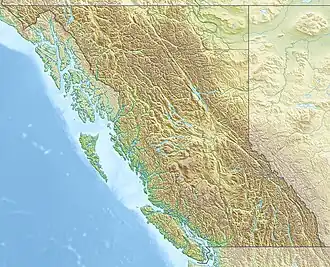 Refugium Range Location in British Columbia | |
| Country | Canada |
| Region | British Columbia |
| Parent range | Vancouver Island Ranges |
The Refugium Range is a low, small mountain range comprising the mountains/hills of the Brooks Peninsula on northern Vancouver Island, British Columbia, Canada. It has an area of 239 km2 (92 sq mi) and is a subrange of the Vancouver Island Ranges which in turn form part of the Insular Mountains.[1] The range was named in 1981 by an expedition which found that peaks higher than 700 m (2,300 ft) were above the glaciers during the last ice age and are therefore a refugium with unique plants.[2]
See also
- List of mountain ranges
- Brooks Peninsula Provincial Park
- Brooks Peninsula
References
- ↑ Refugium Range in the Canadian Mountain Encyclopedia
- ↑ "Refugium Range". BC Geographical Names.
This article is issued from Wikipedia. The text is licensed under Creative Commons - Attribution - Sharealike. Additional terms may apply for the media files.