Rainbow Range (Rocky Mountains)
| Rainbow Range | |
|---|---|
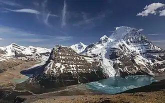 Lynx Mountain, Rearguard Mountain, Resplendent Mountain, Mount Robson, and Berg Lake | |
| Highest point | |
| Peak | Mount Robson |
| Elevation | 3,954 m (12,972 ft)[1] |
| Prominence | 2,829 m (9,281 ft)[2] |
| Listing |
|
| Coordinates | 53°06′38″N 119°09′23″W / 53.11056°N 119.15639°W[3] |
| Dimensions | |
| Area | 497 km2 (192 sq mi)[4] |
| Geography | |
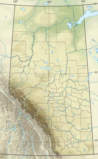 Rainbow Range Location in Alberta 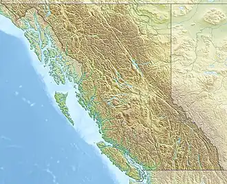 Rainbow Range Location in British Columbia 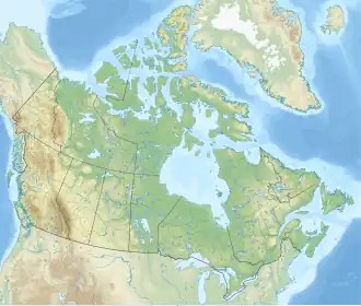 Rainbow Range Location in Canada | |
| Country | Canada |
| Provinces |
|
| Range coordinates | 53°03′N 119°03′W / 53.050°N 119.050°W[5] |
| Parent range | Canadian Rockies |
| Topo map | NTS 83D15 Lucerne[5] |
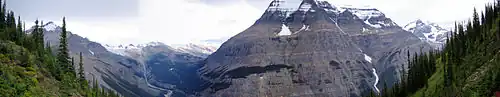
The Rainbow Range is a small subrange of the Park Ranges subdivisions of the Northern Continental Ranges of the Rocky Mountains on the border between Alberta and British Columbia in Mount Robson Provincial Park.
Its highest summit, and the highest in the Canadian Rockies, is Mount Robson 3,954 m (12,972 ft), followed by nearby Resplendent Mountain 3,425 m (11,237 ft).
Mountains and peaks
| Name | Elevation | Prominence | FA | Easiest route | Coordinates | ||
|---|---|---|---|---|---|---|---|
| m | ft | m | ft | ||||
| Mount Robson | 3,954 | 12,972 | 2,829 | 9,281 | 1913 | South face (UIAA IV) | 53°6'38"N, 119°9'24"W |
| Resplendent Mountain | 3,425 | 11,237 | 483 | 1,585 | 1911 | North face (UIAA II) | 53°5'15"N, 119°5'53"W |
| The Helmet | 3,420 | 11,220 | 128 | 420 | 1928 | 53°6'54"N, 119°8'30"W | |
| Lynx Mountain | 3,192 | 10,472 | 425 | 1,394 | 1913 | 53°7'35"N, 119°2'53"W | |
| Tatei Ridge | 2,911 | 9,551 | 80 | 260 | Tatei is the Stoney Indian word for "wind" | 53°9'39"N, 119°4'46"W | |
| Mount Waffl | 2,890 | 9,480 | 163 | 535 | |||
| Mount Kain | 2,880 | 9,450 | 239 | 784 | 1934 | Basic rock climb | 53°3'8"N, 119°2'25"W |
| Titkana Peak | 2,804 | 9,199 | 397 | 1,302 | 1908 | 53°9'18"N, 119°3'54"W | |
| Rearguard Mountain | 2,744 | 9,003 | 454 | 1,490 | 1913 | Glacier travel, scramble | 53°8'38"N, 119°7'35"W |
| Razor Peak | 2,667 | 8,750 | 656 | 2,152 | |||
| Extinguisher Tower | 2,393 | 7,851 | 48 | 157 | 53°7'10"N, 119°5'44"W | ||
| Campion Mountain | 2,137 | 7,011 | 75 | 246 | |||
References
- ↑ "Mount Robson Provincial Park". BC Parks. Government of British Columbia. Retrieved 2019-08-19.
- ↑ "Mount Robson". Bivouac.com. Retrieved 2023-07-15.
- ↑ "Mount Robson". Geographical Names Data Base. Natural Resources Canada. Retrieved 2019-08-19.
- ↑ "Rainbow Range". Peakbagger.com. Retrieved 2012-05-19.
- 1 2 "Rainbow Range". BC Geographical Names. Retrieved 2012-05-19.
External links
- Bivouac - Rainbow Range
This article is issued from Wikipedia. The text is licensed under Creative Commons - Attribution - Sharealike. Additional terms may apply for the media files.