Ngawa Tibetan and Qiang Autonomous Prefecture
Aba Prefecture
阿坝州 · རྔ་བ་ཁུལ། · Rrmeabba Legea | |
|---|---|
Autonomous prefecture | |
阿坝藏族羌族自治州 · རྔ་བ་བོད་རིགས་ཆ་བ༹ང་རིགས་རང་སྐྱོང་ཁུལ། · Rrmeabba Shbea Rrmea Nyujwju Gvexueaj Legea Ngawa Tibetan and Qiang Autonomous Prefecture | |
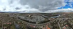
 Jiuzhaigou National Park | |
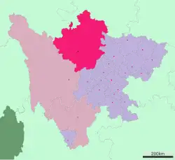 Ngawa-Qiang Autonomous Prefecture (top centre) in Sichuan | |
| Coordinates (Ngawa Prefecture government): 31°54′N 102°13′E / 31.90°N 102.22°E | |
| Country | China |
| Province | Sichuan |
| Prefecture seat | Barkam (Barkam Town) |
| Government | |
| • Type | Autonomous prefecture |
| • CCP Secretary | Xu Zhivin |
| • Congress Chairman | Luo Zhenhua |
| • Governor | Yang Kening |
| • CPPCC Chairman | Nyima Mu |
| Area | |
• Total | 83,201 km2 (32,124 sq mi) |
| Population (2022) | |
• Total | 895,200 |
| • Density | 11/km2 (28/sq mi) |
| • Major Ethnic Groups | Tibetan−60.2% Han−18.0% Qiang- 18.5% Hui−3.1% |
| GDP[1] | |
| • Total | CN¥ 26.5 billion US$ 4.3 billion |
| • Per capita | CN¥ 28,647 US$ 4,599 |
| Time zone | UTC+08:00 (China Standard) |
| Area code | 0837 |
| ISO 3166 code | CN-SC-32 |
| License Plate Prefix | 川U |
| Website | Aba China |
| Ngawa Tibetan and Qiang Autonomous Prefecture | |||||||
|---|---|---|---|---|---|---|---|
| Chinese name | |||||||
| Simplified Chinese | 阿坝藏族羌族自治州 | ||||||
| Traditional Chinese | 阿壩藏族羌族自治州 | ||||||
| |||||||
| Abbreviated as "Aba Prefecture" | |||||||
| Simplified Chinese | 阿坝州 | ||||||
| Traditional Chinese | 阿壩州 | ||||||
| |||||||
| Tibetan name | |||||||
| Tibetan | རྔ་བ་བོད་རིགས་དང་ཆང་རིགས་རང་སྐྱོང་ཁུལ། | ||||||
| |||||||
Ngawa Tibetan and Qiang Autonomous Prefecture, also known as Aba (Tibetan: རྔ་བ་བོད་རིགས་དང་ཆང་རིགས་རང་སྐྱོང་ཁུལ།, Wylie: rnga ba bod rigs cha'ang rigs rang skyong khul; Qiang: Rrmeabba Shbea Rrmea Nyujwju Gvexueaj Legea; simplified Chinese: 阿坝藏族羌族自治州; traditional Chinese: 阿壩藏族羌族自治州), is an autonomous prefecture of northwestern Sichuan, bordering Gansu to the north and northeast and Qinghai to the northwest. Its seat is in Barkam, and it has an area of 83,201 km2 (32,124 sq mi). The population was 895,200 by 2022.[2]
The county of Wenchuan in Ngawa is the site of the epicenter of the 2008 Sichuan earthquake, in which over 20,000 of its residents died and 40,000 were injured.
History and names
During the reign of Tibet's king Trisong Detsen in the 8th century, the Gyalrong area was visited by the great translator Vairotsana.
In 1410 Je Tsongkhapa's student Tshakho Ngawang Tapa established the first Tibetan Buddhist Gelug school monastery in the area, called "Gyalrong".
In contemporary history, most of Ngawa was under the 16th Administrative Prefecture of Szechwan (四川省第十六行政督察區), which was established by the Republic of China (ROC).[3]
The People's Republic of China defeated ROC troops in this area during Chinese Civil war and subsequently established a Tibetan autonomous prefecture by late 1952. It was renamed Aba Tibetan Autonomous Prefecture in 1956 and Aba Tibetan and Qiang Autonomous Prefecture in 1987.[4]
On May 12, 2008, a major earthquake occurred in Wenchuan County (Tibetan: ལུང་དགུ་, Wylie: lung dgu), a county in the southeastern part of this autonomous prefecture. 20,258 people were killed, 45,079 injured, 7,696 missing in the prefecture as of June 6, 2008.[5][6]
Geography
Most of the prefecture lies in the Tibetan cultural and historical region of Amdo. The west, and part of Kardze, is also known as Gyalrong. Gyalrong people speak a Qiangic language known as Gyalrong language. The source of the Min River and its tributary Dadu River are to be found in Ngawa.
Demographics
As of 2013, the prefecture's population was 919,987 inhabitants at a density of 10.91 per km2:[7]
| Ethnic group | Population | Proportion of total |
|---|---|---|
| Tibetan | 489,747 | 57.3% |
| Han | 220,353 | 20.6% |
| Qiang | 157,905 | 18.6% |
| Hui | 26,353 | 3.3% |
| Yi | 685 | 0.08% |
| Manchu | 373 | 0.04% |
| Miao | 266 | 0.03% |
| Mongols | 202 | 0.02% |
| Tujia | 182 | 0.02% |
| Bai | 101 | 0.01% |
| Zhuang | 95 | 0.01% |
| others | 278 | 0.03% |
Languages
Major languages spoken in Aba Prefecture include Tibetan, Mandarin Chinese and many vernaculars of the Qiangic languages which vary from county to county:
- Barkam: rGyalrong
- Li County: Southern Qiang, rGyalrong
- Mao County: Northern Qiang, Southern Qiang
- Jiuzhaigou County: Baima
- Jinchuan County: Khroskyabs, rGyalrong
- Xiaojin County: rGyalrong
- Heishui County: Northern Qiang, rGyalrong
- Zamtang County: Amdo Tibetan
In April 2020, classroom instruction was switched from Tibetan to Mandarin Chinese in Ngaba.[8]
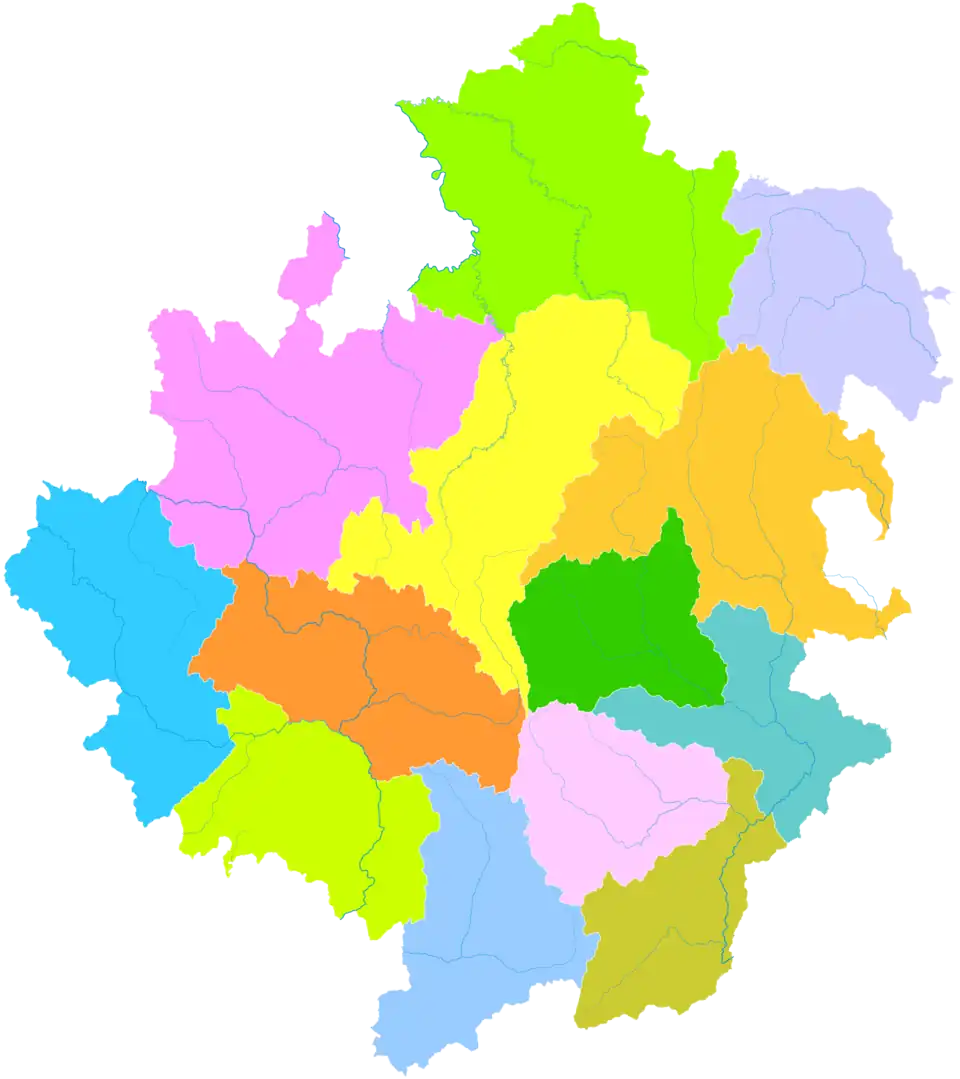
Administrative divisions
The region is composed of one county-level city and twelve counties:
Map
Barkam
(city) Wenchuan
County Li
County Mao
County Songpan
County Jiuzhaigou
County Jinchuan
County Xiaojin
County Heishui
County Zamtang
County Ngawa
County Zoigê
County Hongyuan
County | |||||||||
|---|---|---|---|---|---|---|---|---|---|
| # | Name | Hanzi | Pinyin | Tibetan | Wylie | Qiang | Population (2010 Census) |
Area (km2) | Density (/km2) |
| 1 | Barkam City (Ma'erkang City) |
马尔康市 | Mǎ'ěrkāng Shì | འབར་ཁམས་གྲོང་ཁྱེར། | 'bar khams rdzong | Muerkvua shi | 58,437 | 6,639 | 8.80 |
| 2 | Wenchuan County | 汶川县 | Wènchuān Xiàn | ལུང་དགུ་རྫོང་། / ཁྲི་ཚང་རྫོང་། | lung dgu rdzong / khri tshang rdzong | 100,771 | 4,083 | 24.68 | |
| 3 | Li County | 理县 | Lǐ Xiàn | བཀྲ་ཤིས་གླིང་། | bkra shis gling | pauɕuq | 46,556 | 4,318 | 10.78 |
| 4 | Mao County | 茂县 | Mào Xiàn | མའོ་ཝུན། | ma'o wun | ʂqini | 104,829 | 4,075 | 25.72 |
| 5 | Songpan County | 松潘县 | Sōngpān Xiàn | ཟུང་ཆུ་རྫོང་། | zung chu rdzong | 72,309 | 8,486 | 8.52 | |
| 6 | Jiuzhaigou County | 九寨沟县 | Jiǔzhàigōu Xiàn | གཟི་རྩ་སྡེ་དགུ་རྫོང་། | gzi rtsa sde dgu rdzong | 81,394 | 5,286 | 15.39 | |
| 7 | Jinchuan County | 金川县 | Jīnchuān Xiàn | ཆུ་ཆེན་རྫོང་། | chu chen rdzong | 65,976 | 5,524 | 11.94 | |
| 8 | Xiaojin County | 小金县 | Xiǎojīn Xiàn | བཙན་ལྷ་རྫོང་། | btsan lha rdzong | 77,731 | 5,571 | 13.95 | |
| 9 | Heishui County | 黑水县 | Hēishuǐ Xiàn | ཁྲོ་ཆུ་རྫོང་། | khro chu rdzong | khǝtʂǝp | 60,704 | 4,154 | 14.61 |
| 10 | Zamtang County (Rangtang County) |
壤塘县 | Rǎngtáng Xiàn | འཛམ་ཐང་རྫོང་། | 'dzam thang rdzong | 39,173 | 6,836 | 5.73 | |
| 11 | Ngawa County (Aba County) |
阿坝县 | Ābà Xiàn | རྔ་བ་རྫོང་། | rnga ba rdzong | Ggabba | 72,391 | 10,435 | 6.93 |
| 12 | Zoigê County (Ruo'ergai County) |
若尔盖县 | Ruò'ěrgài Xiàn | མཛོད་དགེ་རྫོང་། | mdzod dge rdzong | 74,619 | 10,437 | 7.14 | |
| 13 | Hongyuan County | 红原县 | Hóngyuán Xiàn | རྐ་ཁོག་རྫོང་། / ཁྱུང་མཆུ་རྫོང་། | rka khog rdzong / khyung mchu rdzong | 43,818 | 8,398 | 5.21 | |
Though situated within Wenchuan County, Wolong National Nature Reserve and Wolong Special Administrative Region are administered separately by the Forestry Department of Sichuan.
Transportation
The prefecture is served by Hongyuan Airport in the west and Jiuzhai Huanglong Airport in the east. Private taxis can be hired from these airports. Jiuzhaigou Train Station is under construction 55 km (34 mi) north-west of Jiuzhaigou County's town. The railway is to run between Chengdu and Lanzhou.
Tourism
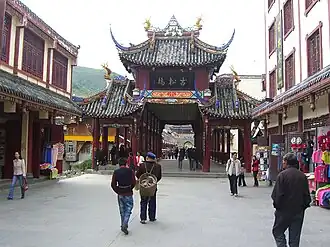

Tourism produced 71.0% of the GDP of the prefecture in 2006.[9] There are many places of interest in the prefecture, including
- Wolong National Nature Reserve in Wenchuan County, a well-known giant panda reserve where the China Conservation and Research Center for the Giant Panda was established in 1980
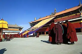
- Kirti Gompa, a 15th-century Tibetan Buddhism monastery
- Nangzhik Gompa monastery, founded in the 12th century
- Huanglong Scenic and Historic Interest Area in Songpan County
- Jiuzhaigou, Jiuzhaigou County, a nature reserve known for its many multi-level waterfalls and colorful lakes, declared a UNESCO World Heritage Site in 1992
- Mount Siguniang (Chinese: 四姑娘山 Tibetan: སྐུ་བླ, Wylie: sku bla "Sku Mountain"; formerly Chinese: 四姑山, a transcription), the highest point of the Qionglai Mountains, on the border between Xiaojin County (Chinese: 小金县; Tibetan: Tibetan: བཙན་ལྷ) and Wenchuan County.
References
- ↑ 四川省统计局、国家统计局四川调查总队 (September 2016). 《四川统计年鉴-2016》. China Statistics Press. ISBN 978-7-5037-7871-1.
- ↑ "阿坝藏族羌族自治州2022年国民经济和社会发展统计公报_阿坝藏族羌族自治州统计局" [Aba Tibetan and Qiang Autonomous Prefecture 2022 National Economic and Social Development Statistics]. 阿坝州统计局 (in Chinese). Retrieved 2024-02-05.
- ↑ "Öйú°¢°ÓÖÝ". abazhou.gov.cn. Archived from the original on 2008-02-11. Retrieved 2008-05-30.
- ↑ 历史和民族. Ngawa Prefecture People's Government. Archived from the original on 2007-06-30. Retrieved 2018-08-13.
- ↑ 伤亡汇报_四川汶川强烈地震_新闻中心_新浪网. Sina.com (in Chinese (China)). 2008-06-02. Retrieved 2008-06-02.
- ↑ 截至6月6日18时阿坝州地震灾区遇难人员达20258人 (in Chinese (China)). Ngawa Prefecture People's Government. 2008-06-07. Archived from the original on 2008-06-09. Retrieved 2008-06-07.
- ↑ 基本州情 (in Chinese). Ngawa Prefecture People's Government. Archived from the original on 2017-08-03. Retrieved 2015-05-04.
- ↑ Lobe Socktsang; Richard Finney. (9 April 2020). "Classroom Instruction Switch From Tibetan to Chinese in Ngaba Sparks Worry, Anger". Translated by Dorjee Damdul. Retrieved 12 April 2020.
- ↑ Ngawa Prefecture Government. 中国阿坝州. abazhou.gov.cn (in Simplified Chinese). Archived from the original on 2008-06-08. Retrieved 2008-05-30.
Further reading
- A. Gruschke (2001) The Cultural Monuments of Tibet's Outer Provinces: Amdo - Volume 2. The Gansu and Sichuan Parts of Amdo. Bangkok: White Lotus Press ISBN 974-480-049-6
- Tsering Shakya (1999) The Dragon in the Land of Snows.: a history of modern Tibet since 1947, London: Pimlico, 1999, ISBN 0-14-019615-3
External links
Notes: *Provincial capitals, ★Sub-provincial cities, ☆Sub-provincial autonomous prefecture *Sub prefectural-level divisions, ✧"Comparatively larger city" (较大的市) as approved by the State Council | |||||||||||||||||||||||||||||||||||||||||||||||||||||||||||||||||
| |||||||||||||||||||||||||||||||||||||||||||||||||||||||||||||||||
| |||||||||||||||||||||||||||||||||||||||||||||||||||||||||||||||||
See also: List of prefectures in China, List of cities in China | |||||||||||||||||||||||||||||||||||||||||||||||||||||||||||||||||
Tibetan-designated autonomous areas in China | |||||||||
|---|---|---|---|---|---|---|---|---|---|
| Regions |
| 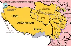 | |||||||
| Prefectures and counties |
| ||||||||
| |||||||||