Nazarabad County
Nazarabad County
Persian: شهرستان نظرآباد | |
|---|---|
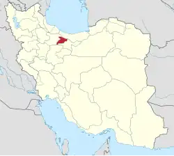
 Location of Nazarabad County in Alborz province (left, green) | |
 Location of Alborz province in Iran | |
| Coordinates: 35°56′N 50°33′E / 35.933°N 50.550°E[1] | |
| Country | |
| Province | Alborz |
| Established | 2002[2] |
| Capital | Nazarabad |
| Districts | Central, Tankaman |
| Area | |
• Total | 612 km2 (236 sq mi) |
| Population (2016)[3] | |
• Total | 152,437 |
| • Density | 250/km2 (650/sq mi) |
| Time zone | UTC+3:30 (IRST) |
| Nazarabad County can be found at GEOnet Names Server, at this link, by opening the Advanced Search box, entering "9206119" in the "Unique Feature Id" form, and clicking on "Search Database". | |
Nazarabad County (Persian: شهرستان نظرآباد) is in Alborz province, Iran. Its capital is the city of Nazarabad.[2]
History
In 2008, Jamal ol Din Rural District was created in the Central District, and Najmabad Rural District was separated from Tankaman District to join the Central District. Tankaman-e Shomali Rural District was created in Tankaman District, and the village of Tankaman was elevated to the status of a city.[4]
In 2010, the county was separated from Tehran province in the establishment of Alborz province.[5]
Demographics
Population
At the time of the 2006 National Census, the county's population was 128,666 in 32,373 households.[6] The 2016 census measured the population of the county as 152,437 in 46,658 households.[3]
Administrative divisions
Nazarabad County's population history and administrative structure over two censuses are shown in the following table.
| Administrative Divisions | 2006[6] | 2016[3] | |
|---|---|---|---|
| Central District | 103,476 | 133,712 | |
| Ahmadabad RD | 5,792 | 6,053 | |
| Jamal ol Din RD | 1,443 | ||
| Najmabad RD | 6,704 | ||
| Nazarabad (city) | 97,684 | 119,512 | |
| Tankaman District | 25,190 | 18,723 | |
| Najmabad RD | 8,880 | ||
| Tankaman-e Jonubi RD[b] | 16,310 | 3,279 | |
| Tankaman-e Shomali RD | 10,790 | ||
| Tankaman (city) | 4,654 | ||
| Total | 128,666 | 152,437 | |
| RD = Rural District | |||
See also
![]() Media related to Nazarabad County at Wikimedia Commons
Media related to Nazarabad County at Wikimedia Commons
![]() Iran portal
Iran portal
Notes
- ↑ As a part of Tehran province at the 2006 Census
- ↑ Formerly Tankaman Rural District[4]
References
- ↑ OpenStreetMap contributors (1 May 2025). Nazarabad County (Map) (in Persian). Retrieved 1 May 2025.
- 1 2 Aref, Mohammad Reza (2002) [Approved 28 November 1381]. Approval of changes and reforms in Tehran province. lamtakam.com (Report) (in Persian). Ministry of the Interior, Political-Defense Commission of the Cabinet of Ministers. Notification 44725/T26982K. Archived from the original on 16 December 2023. Retrieved 16 December 2023 – via Lam ta Kam.
- 1 2 3 Census of the Islamic Republic of Iran, 1395 (2016): Alborz Province. amar.org.ir (Report) (in Persian). The Statistical Center of Iran. Archived from the original (Excel) on 28 January 2020. Retrieved 19 December 2022.
- 1 2 Davodi, Parviz (2007) [Approved 18 September 1386]. Approval letter regarding reforms of national divisions in Tehran province. rc.majlis.ir (Report) (in Persian). Ministry of the Interior, Political-Defense Commission of the Government Board. Notification 156150/T32688K. Archived from the original on 15 September 2017. Retrieved 21 August 2024 – via The Research Center of the Islamic Council of Iran.
- ↑ Larijani, Ali (2010) [Approved 16 April 1389]. Alborz province establishment law. lamtakam.com (Report) (in Persian). Guardian Council. Notification 412/30588. Archived from the original on 16 December 2023. Retrieved 21 August 2024 – via Lam ta Kam.
- 1 2 Census of the Islamic Republic of Iran, 1385 (2006): Tehran Province. amar.org.ir (Report) (in Persian). The Statistical Center of Iran. Archived from the original (Excel) on 20 September 2011. Retrieved 25 September 2022.
| Capital city | 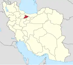 | ||||||||||||
|---|---|---|---|---|---|---|---|---|---|---|---|---|---|
| Counties and cities |
| ||||||||||||
| Sights |
| ||||||||||||
| Populated places |
| ||||||||||||