Moncloa-Aravaca
Moncloa-Aravaca | |
|---|---|
District | |
 Plaza de Moncloa | |
| Country | Spain |
| Aut. community | Community of Madrid |
| Municipality | Madrid |
| Government | |
| • Councillor-President | Borja Fanjul (PP, 2023) |
| Area | |
• Total | 32.89 km2 (12.70 sq mi) |
| Population | 116.531 |
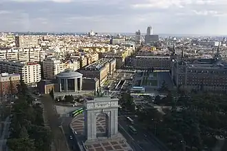
Moncloa-Aravaca is a district of the municipality of Madrid, Spain. It is located to the northwest of the city centre, spanning across both banks of the Manzanares. It is made up of the neighborhoods of Aravaca, Argüelles, Casa de Campo, Ciudad Universitaria, El Plantío, Valdemarín and Valdezarza.
The Palace of Moncloa, located in Ciudad Universitaria, is the residence of the Spanish Prime Minister.
Geography
Subdivision
The district is administratively divided into 7 neighborhoods (barrios):
- Aravaca
- Argüelles
- Casa de Campo
- Ciudad Universitaria
- El Plantío
- Valdemarín
- Valdezarza
Education
The Colegio Japonés de Madrid, the Japanese international school in Madrid, is located in the El Plantío area.[1]
See also
- Faro de Moncloa
- Palacio de la Moncloa
References
- ↑ "Como llegar." (Archive) Colegio Japonés de Madrid. Retrieved on 5 January 2014. "Avda. de la Victoria, 98, El Plantio 28023 Madrid Spain"
External links
Wikivoyage has a travel guide for Moncloa-Aravaca.
![]() Media related to Moncloa-Aravaca at Wikimedia Commons
Media related to Moncloa-Aravaca at Wikimedia Commons
Districts and wards of Madrid | ||
|---|---|---|
| Arganzuela |
| |
| Barajas |
| |
| Carabanchel |
| |
| Centro |
| |
| Chamartín |
| |
| Chamberí |
| |
| Ciudad Lineal |
| |
| Fuencarral-El Pardo |
| |
| Hortaleza |
| |
| Latina |
| |
| Moncloa-Aravaca |
| |
| Moratalaz |
| |
| Puente de Vallecas |
| |
| Retiro |
| |
| Salamanca |
| |
| San Blas-Canillejas |
| |
| Tetuán |
| |
| Usera |
| |
| Vicálvaro |
| |
| Villa de Vallecas |
| |
| Villaverde |
| |
40°26′07″N 3°43′08″W / 40.435151°N 3.718765°W
This article is issued from Wikipedia. The text is licensed under Creative Commons - Attribution - Sharealike. Additional terms may apply for the media files.