Emamzadeh Jafar Rural District
Emamzadeh Jafar Rural District
Persian: دهستان امامزاده جعفر | |
|---|---|
Rural District | |
 Emamzadeh Jafar Rural District | |
| Coordinates: 30°19′48″N 50°56′23″E / 30.33000°N 50.93972°E[1] | |
| Country | Iran |
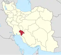
| Province | Kohgiluyeh and Boyer-Ahmad |
| County | Gachsaran |
| District | Central |
| Capital | Emamzadeh Jafar |
| Population (2016)[2] | |
• Total | 13,339 |
| Time zone | UTC+3:30 (IRST) |
Emamzadeh Jafar Rural District (Persian: دهستان امامزاده جعفر) is in the Central District of Gachsaran County, Kohgiluyeh and Boyer-Ahmad province, Iran.[3] Its capital is the village of Emamzadeh Jafar.[4]
Demographics
Population
At the time of the 2006 National Census, the rural district's population was 12,817 in 2,792 households.[5] There were 12,203 inhabitants in 3,135 households at the following census of 2011.[6] The 2016 census measured the population of the rural district as 13,339 in 3,592 households. The most populous of its 72 villages was Ab Garmu, with 1,816 people.[2]
See also
![]() Iran portal
Iran portal
References
- ↑ OpenStreetMap contributors (26 December 2024). "Emamzadeh Jafar Rural District (Gachsaran County)" (Map). OpenStreetMap (in Persian). Retrieved 26 December 2024.
- 1 2 Census of the Islamic Republic of Iran, 1395 (2016): Kohgiluyeh and Boyer-Ahmad Province. amar.org.ir (Report) (in Persian). The Statistical Center of Iran. Archived from the original (Excel) on 2 November 2021. Retrieved 19 December 2022.
- ↑ Habibi, Hassan (c. 2024) [Approved 7 July 1369]. Approval of the organization and chain of citizenship of the units of the national divisions of Kohgiluyeh and Boyer-Ahmad province, centered in the city of Yasuj. lamtakam.com (Report) (in Persian). Ministry of the Interior, Defense Political Commission of the Government Council. Proposal 3233.1.5.53; Letter 93808-907; Notification 82818/T143K. Archived from the original on 24 January 2024. Retrieved 24 January 2024 – via Lam ta Kam.
- ↑ Mousavi, Mirhossein (19 December 1390) [Approved 2 February 1366]. Creation and establishment of six rural districts including villages, farms and places in Gachsaran County under Kohgiluyeh and Boyer-Ahmad province. rc.majlis.ir (Report) (in Persian). Ministry of the Interior, Council of Ministers. Proposal 5.53.1.7682; Notification 122134/T721. Archived from the original on 8 March 2012. Retrieved 24 January 2024 – via Islamic Parliament Research Center.
- ↑ Census of the Islamic Republic of Iran, 1385 (2006): Kohgiluyeh and Boyer-Ahmad Province. amar.org.ir (Report) (in Persian). The Statistical Center of Iran. Archived from the original (Excel) on 20 September 2011. Retrieved 25 September 2022.
- ↑ Census of the Islamic Republic of Iran, 1390 (2011): Kohgiluyeh and Boyer-Ahmad Province. irandataportal.syr.edu (Report) (in Persian). The Statistical Center of Iran. Archived from the original (Excel) on 19 January 2023. Retrieved 19 December 2022 – via Iran Data Portal, Syracuse University.
Kohgiluyeh and Boyer-Ahmad province, Iran | |||||||||||||||||||
|---|---|---|---|---|---|---|---|---|---|---|---|---|---|---|---|---|---|---|---|
| Capital |
|  | |||||||||||||||||
| Counties and cities |
| ||||||||||||||||||
| Sights |
| ||||||||||||||||||
| populated places |
| ||||||||||||||||||
This article is issued from Wikipedia. The text is licensed under Creative Commons - Attribution - Sharealike. Additional terms may apply for the media files.