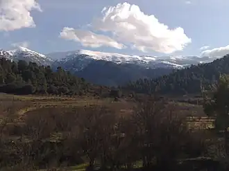
Djebel Chélia
| Djebel Chélia | |
|---|---|
| جبل شيليا | |
 | |
| Highest point | |
| Elevation | 2,328 m (7,638 ft)[1] |
| Prominence | 1,612 m (5,289 ft)[1] |
| Listing | Ultra, Ribu |
| Coordinates | 35°19′06″N 06°38′15″E / 35.31833°N 6.63750°E[1] |
| Geography | |
 Djebel Chélia | |
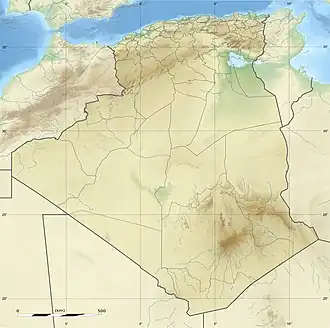
| Country | Algeria |
| Parent range | Aurès Mountains, Saharan Atlas |
Djebel Chélia (Arabic: جبل شيليا) is a mountain in Algeria. It is the highest point in the Aurès Mountains and the second highest peak in Algeria after Mount Tahat. Djebel Chélia is situated in the west of Khenchela, in Bouhmama county. Abiod Valley begins at the foot of Djebel Chélia.[2]
See also
- List of mountains in Algeria
- List of Ultras of Africa
References
- 1 2 3 "Africa Ultra-Prominences". peaklist.org. Retrieved 2012-01-14.
- ↑ Scheffel, Richard L.; Wernet, Susan J., eds. (1980). Natural Wonders of the World. United States of America: Reader's Digest Association, Inc. p. 27. ISBN 0-89577-087-3.
External links
| Tell Atlas |
|
|---|---|
| Saharan Atlas |
|
| Saharan massifs |
|
| Peaks |
|
| |
This article is issued from Wikipedia. The text is licensed under Creative Commons - Attribution - Sharealike. Additional terms may apply for the media files.