Cinder Cone (British Columbia)
| Cinder Cone | |
|---|---|
 | |
| Highest point | |
| Elevation | 1,910 m (6,270 ft) |
| Prominence | 120 m (390 ft) |
| Coordinates | 49°58′18″N 123°00′25″W / 49.97167°N 123.00694°W |
| Geography | |
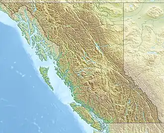 Cinder Cone Location in British Columbia | |
| Location in Garibaldi Provincial Park | |
| Location | British Columbia, Canada |
| District | New Westminster Land District |
| Parent range | Garibaldi Ranges |
| Topo map | NTS 92G14 Cheakamus River |
| Geology | |
| Rock age | Holocene |
| Mountain type | Cinder cone |
| Volcanic arc/belt | Cascade Volcanic ArcGaribaldi Volcanic Belt |
| Last eruption | Holocene |
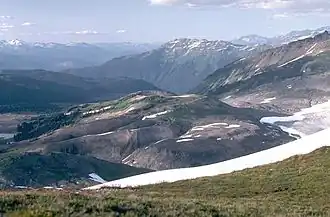
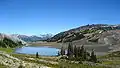
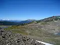
Cinder Cone is a cinder cone with a small crater on the west side of the Helm Glacier in Garibaldi Provincial Park in British Columbia, Canada. Cinder Cone is surrounded by cinder flats and its crater is filled with meltwater during the summer. Cinder Cone is eroded easily by meltwater during the spring, washing the pyroclastics into the Valley of Desolation. Cinder Cone produced a 9 km (6 mi) long lava flow during the early Holocene.
Gallery
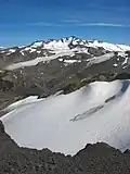 Cinder Cone and Helm Glacier
See also
- List of Cascade volcanoes
- List of volcanoes of Canada
- Volcanism of Western Canada
References
- "Cinder Cone". BC Geographical Names.
- "Cinder Cone". Bivouac.com.
This article is issued from Wikipedia. The text is licensed under Creative Commons - Attribution - Sharealike. Additional terms may apply for the media files.