Borders of India
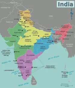
The Republic of India shares borders with several sovereign countries; it shares land borders with China, Bhutan, Nepal, Pakistan, Bangladesh, and Myanmar.[1] Bangladesh, Myanmar, and Pakistan share both land borders as well as maritime borders, while Sri Lanka shares only a maritime border through Ram Setu. India's Andaman and Nicobar Islands share a maritime border with Thailand, Myanmar, and Indonesia.
Borders
Policy
India does not have a National Border Policy. For the strategic national interest reasons, there are suggestions that India must define a National Border Policy to comprehensively deal with border related issues, not just the fencing of open borders but also to deal with the negative consequences of porous borders. For example, India-Nepal border is an open border with no fence, which has been misused by Pakistan's ISI to create trouble in India.[2]
Land
Barriers
India has constructed the fences along the following borders:[3]
Borders
India shares land borders with six sovereign nations. The state's Ministry of Home Affairs also recognizes a 106 kilometres (66 mi) land border with a seventh nation, Afghanistan, as part of its claim on the Kashmir region; however, this is disputed and the region bordering Afghanistan has been administered by Pakistan as part of Gilgit-Baltistan since 1947 (see Durand Line).[4]
| Land Border Country | Dispute | Length (Km) and (mi) | Force | Comments |
|---|---|---|---|---|
| N | 4,096 kilometres (2,545 mi) | Border Security Force | Most of the India–Bangladesh enclaves exchanged in 2015. See Bangladesh Liberation War and Bangladesh–India relations. | |
| N | 578 kilometres (359 mi)[5] | Sashastra Seema Bal | Open border. See Bhutan–India relations. | |
| Y | 3,488 kilometres (2,167 mi) | Indo-Tibetan Border Police and Special Frontier Force | Also see Ardagh–Johnson Line, Macartney–MacDonald Line, McMahon Line, Sino-Indian border dispute and China–India relations. | |
| N | 1,643 kilometres (1,021 mi) | Assam Rifles and Indian Army | See India-Myanmar relations. | |
| Y | 1,752 kilometres (1,089 mi)[6] | Sashastra Seema Bal | Open border. See Kalapani territory, Susta territory and India-Nepal relations. | |
| Y | 3,320 kilometres (2,060 mi) | Border Security Force | Also see Radcliffe Line, Line of Control, Actual Ground Position Line and Sir Creek. See Partition of India, Indo-Pakistani wars and conflicts and India-Pakistan relations. | |
| Y | 106 kilometres (66 mi) | see Durand Line |
Border ceremonies
India co-hosts the joint ceremonies with the neighbouring nations at the following border crossings. The most attended and emotionally charged among these is the one at Wagha-Attari Border near Amritsar-Lahore.
| Border | Ceremony Locations | Notes |
|---|---|---|
| India-Pakistan border | Attari–Wagah border ceremony near Amritsar in Punjab.[7][8] | Most attended and emotionally charged ceremony |
| Ganda Singh Wala–Hussainiwala border ceremony near Firozepur in Punjab.[7][8] | ||
| Sadqi-Sulemanki border ceremony near Fazilka in Punjab.[9][10][11] | ||
| Khokhrapar–Munabao border ceremony in Barmer district of Rajasthan.[7][8] | ||
| India-China border | Daulat Beg Oldi | Border Personnel Meeting Point (BPM Point) |
| Spanggur Gap (Chushul) | Border Personnel Meeting point | |
| Nathu La | Used for pilgrims to monasteries in Sikkim; reduces journey time to Lake Manasarovar[12] | |
| Bum La Pass (Tawang) | Open on Sundays and during cultural ceremonies | |
| Kaho, India (north of Kibithu in Walong sector) | Border Personnel Meeting point | |
| India-Bangladesh border | Benapole–Petrapole border ceremony | Daily joint ceremony by Border Security Force and Border Guards Bangladesh[13][14] |
Maritime borders and EEZs
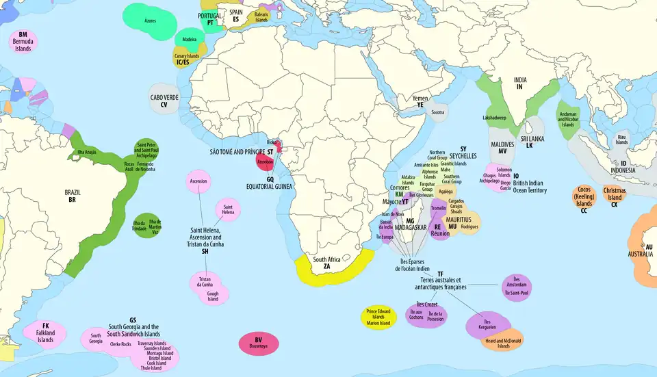
Maritime borders of India are the maritime boundary recognized by the United Nations Convention on the Law of the Sea entails boundaries of territorial waters, contiguous zones, and exclusive economic zones. India, with its claim of a 12-nautical-mile (22 km; 14 mi) territorial maritime zone and 200-nautical-mile (370 km; 230 mi) exclusive economic zone, has a more than 7,000-kilometre (4,300 mi) maritime border shared with seven nations.
| Maritime Border Country | Length (km) and (mi) | Force | Comments |
|---|---|---|---|
| Indian Navy | New Moore Island in Bay of Bengal | ||
| 555 kilometres (345 mi) | Indian Navy | Indira Point in Andaman Sea | |
| Indian Navy | Landfall Island in Andaman Sea | ||
| Indian Navy | Sir Creek in Arabian Sea | ||
| Indian Navy | Similan Islands in Andaman Sea | ||
| >400 kilometres (250 mi)[15] | Indian Navy | Katchatheevu in Palk Strait | |
| 1,009 kilometres (627 mi) | Indian Navy | Maliku Kandu in Laccadive Sea |
Designated border crossings
The map of ICP and LCS.
Integrated Check Posts (ICP)
India has 7 functional ICPs, and plans are underway to upgrade 13 more LCS to ICP, including 7 at borders taking total of border ICP to 14, at the cost of ₹3,005 crore (US$350 million) (c. June 2024 ).[16][17] Designated Integrated Check Posts (ICP), with both customs and immigration facilities are:[18]
| Border | State | Check Post | Status | Notes | References |
|---|---|---|---|---|---|
| India–Bangladesh | Assam | Sutarkandi | Planned | Connects to Golapganj uppozilla in Sylhet District | [16] |
| Meghalaya | Dawki ICP | Operational since 2018 | Connects to Tambil post (Bangladesh) | [19] | |
| Mizoram | Kawrpuichhuah (near Tlabung) | Operational since Oct 2017 | On Khawthalangtuipui river (Karnaphuli) | [16][20][21] | |
| Tripura | Agartala–Akhaura | Operational (c. 2017) | Connects to Dhaka | [17] | |
| Belonia–Parshuram | Road and rail crossing | ||||
| West Bengal | Petrapole | Operational (c. 2017) | Connects Kolkata to Dhaka | [17] | |
| Ghojadanga | Planned | [16][22] | |||
| Mahadipur | In-principle approval (2019) | Connects to Rajshahi | [22][16] | ||
| Fulbari | Planned | [16] | |||
| Hili | Planned | [16] | |||
| India–Bhutan | West Bengal | Jaigaon | Plan approved (c. 2016) | In Alipurduar district | [23] |
| India–Myanmar | Manipur | Moreh ICP | Operational | [24] | |
| Mizoram | Zochawchhuah–Zorinpui | Operational since Oct 2017 | On Kaladan Multi-Modal Transit Transport Project | [24][21] | |
| India–Nepal | Uttarakhand | Banbasa | In-principle approval (2019) | In Champawat district | [22] |
| Bihar | Bhitthamore | In-principle approval (2019) | In Sitamarhi district | [22][25] | |
| Bihar | Jogbani | [23] | |||
| West Bengal | Panitanki | In-principle approval (2019) | In Darjeeling district | [23][22] | |
| Bihar | Raxaul | [23] | |||
| Uttar Pradesh | Sonauli | ||||
| Uttar Pradesh | Rupaidiha | [23] | |||
| Uttar Pradesh | Taulihawa-Siddharthnagar | [23] | |||
| India–Pakistan | Punjab | Attari | Operational (2017) | At Wagah (see Samjhauta Express) | |
| Punjab | Kartarpur Corridor | Visa-free access to Gurdwara Darbar Sahib | |||
| Rajasthan | Munabao | (see Thar Express) |
Land Customs Stations (LCS)
| Border | State | Land Customs Station | Connecting To (Bangladesh) | Status | Notes | References |
|---|---|---|---|---|---|---|
| India–Bangladesh | Assam | Mankachar | Rowmari post (Natun Bandar, Rangpur division) | Functional | [26] | |
| Karimganj Steamer and Ferry Station (KSFS) | Zakiganj post (Sylhet division) | Functional | [26] | |||
| Guwahati Steamer Ghat (Dhubri district) | Functional | [26] | ||||
| Dhubri Steamer Ghat | Rowmati (Maymansingh division) | Functional | [26] | |||
| Mahisasan railway station | Shahbazpur (Sylhet division) | Non-functional | [26] | |||
| Golokganj | Sonahaat (Rangpur Division) | Non-functional | [26] | |||
| Silchar Railway Mail Service | Non-functional | Inland LCS (no border crossing) | [26] | |||
| India–Bangladesh | Meghalaya | Baghmara (South Garo Hills) | Bijoyour post | Functional | [26] | |
| Bholaganj | Chatak (Sunamganj division) | Functional | [26] | |||
| Borsara (West Khasi Hills) | Borsara post | Functional | [26] | |||
| Mahendraganj | Bakshiganj | Functional | On NH12 | [26] | ||
| Dalu | Nakugaon post | Functional | On NH217 | [26] | ||
| Shellabazar | Sunamganj (Sylhet division) | Functional | [26] | |||
| Gasuapara | Karoitol (Mymansing division) | Functional | [26] | |||
| Ryngku (East Khasi Hills) | Kalibari (Sonamganj division) | Non-functional | [26] | |||
| Balat (East Khasi Hills) | Dolura (Sylhet division) | Non-functional | [26] | |||
| India–Bangladesh | Tripura | Srimantapur | Bibir Bazar (Comilla division) | Operational | Became operational January 2016 | [27] |
| Dhalaighat | Kumarghat (Sunamganj division) | Functional | [26] | |||
| Khowaighat | Balla (Habiganj division) | Functional | [26] | |||
| Manu | Chatlapur (Sylhet division) | Functional | [26] | |||
| Muhurighat | Belonia (Feni division) | Functional | [26] | |||
| Old Ragnabazar | Betul (Fultali) (Sylhet division) | Functional | [26] | |||
| India–Bangladesh | Mizoram | Kawarpuchiah | Operational | Opened October 2017 by PM Modi | [28] | |
| Demagiri | Rangamati (Sylhet division) | Non-functional | [26] | |||
| India–Pakistan | Rajasthan | Longewala | In Jaisalmer district |
Border markets
This is incomplete list of designated border markets, also called bazaars and haats, established by the efforts of Ministry of External Affairs.[18]
India–Bangladesh
| State | District | Location | Reference |
|---|---|---|---|
| Meghalaya | East Khasi Hills district | Balat | [29] |
| Bholaganj | [29] | ||
| South West Garo Hills district | Kalaichar | [29] | |
| Ryngku | [29] | ||
| West Garo Hills district | Nalikata | [29] | |
| Shibbari | [29] | ||
| Mizoram | Mamit district | Mapara - Longkor | |
| Tuipuibari - Not provided | |||
| Lunglei district | Silsury - Mahmuam | ||
| Nunsuri - Not provided | |||
| Tripura | West Tripura district | Kamalasagar | |
| Boxanagar | |||
| Bamutia | |||
| South Tripura district | Srinagar, Tripura | ||
| Ekimpur | |||
| North Tripura district | Pal Basti (Raghna) | ||
| Hiracherra (Kailasahar) | |||
| Kamalpur, Tripura (Dhalai) |
India-Bhutan
India-Bhutan Border Haat on India-Bhutan border are in operation, such as the Gelephu-Hatisar border market road entry point,[30] Phuntsholing to its west and Samdrup Jongkhar to its east are two other border market road entry points into Bhutan.
India–Myanmar
India–Myanmar border Haats are.[31][32]
| State | District | Indian Location | Myanmar Location | Reference |
|---|---|---|---|---|
| Arunachal Pradesh | Changlang district | Pangsau Pass (Nampong) | Pangsau, Kachin State | [31][32] |
| Chingsa (Khimiyang Circle) | Langhong, Kachin State | [31][32] | ||
| Makantong (Khimiyang Circle) | Ngaimong, Kachin State | [31][32] | ||
| Tirap district | Wakka/Pongchao/Lazu | Tirap, Kachin State | [31][32] | |
| Manipur | Ukhrul district | Kongkan Thana | Aungci (suggested by State Government) | [31][32] |
| Chandel district | New Somtal | Thenjen, or Khampat | [31][32] | |
| Churachandpur district | Behiang | Khenman, or Chikha | [31][32] | |
| Mizoram | Lawngtlai district | Hruitezawl | Varang | [31][32] |
| Champhai district | Hnahlan | Darkhai | [31][32] | |
| Vaphai | Leilet | [31][32] | ||
| Siaha district | Chakhang | Nviaphia | [31][32] | |
| Nagaland | Tuensang district | Avakhung | Layshi (32 km apart) | [31][32] |
| Pangsha | Lahe/Hkamti District HQ (60 km apart) | [31][32] | ||
| Mon district | Chemoho/Longwa | Lahe (60 km apart) | [31][32] | |
| Phek district | Molhe | Pansat (10 km apart) | [31][32] |
In popular media
Pradeep Damodaran's book Borderlands: Travels Across India's Boundaries chronicles all land borders of India.[33] The Bollywood director J. P. Dutta has specialised in making Hindi movies with India's border as a key element of the theme, his movies are Border, Refugee, LOC: Kargil, Paltan, etc.[34]
Gallery
 Border ceremony at Attari–Wagah border.
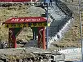 Nathu La border in Sikkim.
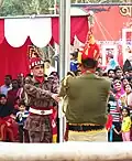 Indian and Bangladeshi soldiers at Benapole–Petrapole border ceremony.
 Signage board at Bhitthamore border.
See also
- India related
- Climate of India
- Geography of India
- Disputed territories of India
- Exclusive economic zone of India
- Extreme points of India
- How different scales of measurement impacts the length of land border
- Development
- Look East policy
- Northeast India connectivity projects
- Lists
- List of countries and territories by land borders
- List of countries and territories by land and maritime borders
- List of countries and territories by maritime boundaries
- List of countries that border only one other country
- List of land borders by date of establishment
- List of divided islands
- List of island nations
- List of political and geographic borders
References
- ↑ "Neighbouring Countries of India 2020: Map, Capitals, Connected States". www.careerpower.in.
- ↑ , Sunday Guardian, 11 Feb 2024
- ↑ 1643 km Indo-Myanmar border to be fenced, a patrol track to be built: Amit Shah, Hindustan Times, 6 Feb 2024.
- ↑ "India Department of Border Management Intro" (PDF).
- ↑ SSB to strengthen presence on India-Bhutan border, Times of India, 20 Dec 2017.
- ↑ "doklam: SSB to strengthen presence on India-Bhutan border | India News - Times of India". The Times of India. 20 December 2017.
- 1 2 3 5 crossing points in India: All you need to know, India Today, 10 OCt 2016.
- 1 2 3 Beating Retreat Wagah India, CHanging Guards, accessed 8 July 2021.
- ↑ Sadqi retreat ceremony, nic.in, accessed 8 July 2021.
- ↑ Second Wagah: India, Pak agree to new ceremony, beating retreat on Punjab border, Hindustan Times, 201 April 2017.
- ↑ At Sadiqi border, strained Indo-Pak ties dampen spirits, The Tribune, 17 April 2019.
- ↑ Vinayak, G (28 July 2004). "Nathu La: closed for review". The Rediff Special. Rediff.com. Archived from the original on 22 February 2006. Retrieved 26 November 2006.
- ↑ "Retreat Ceremony at Indo–Bangladesh Border". PIB. Press Information Bureau. Retrieved 9 April 2016.
- ↑ Kumar, Satish (14 July 2015). India's National Security: Annual Review 2014. Routledge India. p. 512. ISBN 978-1138927438.
- ↑ "Fishing rights disputes between India and Sri Lanka". Archived from the original on 2017-12-22. Retrieved 2017-12-20.
- 1 2 3 4 5 6 7 , Indian Express, Oct 2017.
- 1 2 3 "India plans to construct 7 integrated check posts on the border with Bangladesh". Dhaka Tribune. October 18, 2017.
- 1 2 "Ministry of Development of North Eastern Region, North East India". mdoner.gov.in.
- ↑ Dawki ICP foundation stone laid.
- ↑
- 1 2 "12th Five Year Plan". Archived from the original on 2013-06-19. Retrieved 2019-06-11.
- 1 2 3 4 5 Delhi approves Sutarkandi integrated check post along Indo-Bangla border, North East News, 7 Jan 2019.
- 1 2 3 4 5 6 Indo-Nepal and Indo-Bhutan border to have more ICP, Oct 2016.
- 1 2 India opens two border crossing points with Myanmar, Bangladesh, Times of India, 1 Oct 2017.
- ↑ "सीतामढ़ी के भिठ्ठामोड़ में भारत-नेपाल सीमा के नो-मेंस लैंड पर बनेगा इंटीग्रेटेड चेकपोस्ट".
- 1 2 3 4 5 6 7 8 9 10 11 12 13 14 15 16 17 18 19 20 21 22 ICP and LCS
- ↑ "Tripura opens new land customs station along Bangladesh border". bdnews24.com.
- ↑ "India opens two border crossing points with Myanmar, Bangladesh". @businessline. October 2017.
- 1 2 3 4 5 6 Meghalaya border haats, megindustry.gov.in, accessed 28 Aug 2021.
- ↑ An Ethnographic Insight on Border-Markets: Reflections from the Indo-Bhutan Border, sadf.eu, accessed 23 October 2024.
- 1 2 3 4 5 6 7 8 9 10 11 12 13 14 15 16 Closer economic ties with neighbours vital, The Hindu, 7 May 2019.
- 1 2 3 4 5 6 7 8 9 10 11 12 13 14 15 16 Border haats of India
- ↑ What will you see if you visit the precise point where India ends and Sri Lanka begins?, Scroll.in, 1 March 2017.
- ↑ Adrian M. Athique, 2010, A Line in the Sand: The India–Pakistan Border in the Films of J.P. Dutta, Centre for Critical and Cultural Studies, University of Queensland, Pages 472-499.
External links
- MDoNER Northeast India and SAARC Trade Assessment report
- List of countries that have ratified Law of the Sea Conventions
Borders of Asia | |
|---|---|
| Sovereign states |
|
| States with limited recognition |
|
| Dependencies and other territories |
|
| |