Comitatul Montgomery, Maryland
Comitatul Montgomery (în engleză Montgomery County) este un comitat din statul Maryland, Statele Unite ale Americii. Conform recensământului din 2010 avea o populație de 971.777 de locuitori, iar după estimările din 2013 — 1.016.677 de locuitori,[2] fiind cel mai populat comitat din Maryland. Reședința comitatului este orașul Rockville.[3]
| Comitatul Montgomery, Maryland Montgomery County, Maryland | ||
| Comitat | ||
 | ||
| ||
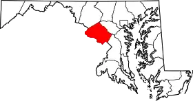 Localizare în statul Maryland | ||
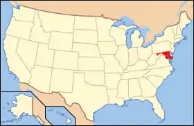 Localizare în SUA a statului Maryland | ||
| Țara | ||
|---|---|---|
| Stat | ||
| Reședință | Rockville | |
| Cel mai mare oraș | Germantown | |
| Fondat | 1776[1] | |
| Suprafață | ||
| • Total | 507 mi2 (1.313,1 km2) | |
| • Pământ | 491 mi2 (1.271,7 km2) | |
| • Apă | 16 mi2 (41,4 km2), 3,1% | |
| Populație (Est.) | ||
| • (2014) | 1.030.447 | |
| • Densitate | 763,7 loc./km² (1.978 loc./mi²) | |
| Fus orar | Eastern: UTC-5/-4 | |
| Site web | www.montgomerycountymd.gov | |

Demografie
| Evoluția numărului populației | |||
|---|---|---|---|
| Recensământ | Pop. | %± | |
| 1790 | 18.003 | — | |
| 1800 | 15.058 | −16,4% | |
| 1810 | 17.980 | 19,4% | |
| 1820 | 16.400 | −8,8% | |
| 1830 | 19.816 | 20,8% | |
| 1840 | 15.456 | −22,0% | |
| 1850 | 15.860 | 2,6% | |
| 1860 | 18.322 | 15,5% | |
| 1870 | 20.563 | 12,2% | |
| 1880 | 24.759 | 20,4% | |
| 1890 | 27.185 | 9,8% | |
| 1900 | 30.451 | 12% | |
| 1910 | 32.089 | 5,4% | |
| 1920 | 34.921 | 8,8% | |
| 1930 | 49.206 | 40,9% | |
| 1940 | 83.912 | 70,5% | |
| 1950 | 164.401 | 95,9% | |
| 1960 | 340.928 | 107,4% | |
| 1970 | 522.809 | 53,3% | |
| 1980 | 579.053 | 10,8% | |
| 1990 | 757.027 | 30,7% | |
| 2000 | 873.341 | 15,4% | |
| 2010 | 971.777 | 11,3% | |
| Est. 2014 | 1.030.447 | 6% | |
Referințe
- „Montgomery County Centennial: An Old-Fashioned Maryland Reunion”. The Baltimore Sun. . p. 1.
- „State & County QuickFacts”. United States Census Bureau. Arhivat din original la . Accesat în .
- American FactFinder, United States Census Bureau. „Maryland by Place – GCT-PH1-R. Population, Housing Units, Area, and Density (geographies ranked by total population): 2000”. Factfinder.census.gov. Arhivat din original la . Accesat în .
- „U.S. Decennial Census”. United States Census Bureau. Accesat în .
- „Historical Census Browser”. University of Virginia Library. Arhivat din original la . Accesat în .
- „Population of Counties by Decennial Census: 1900 to 1990”. United States Census Bureau. Accesat în .
- „Census 2000 PHC-T-4. Ranking Tables for Counties: 1990 and 2000” (PDF). United States Census Bureau. Accesat în .
Legături externe
 Materiale media legate de comitatul Montgomery la Wikimedia Commons
 Date geografice legate de Comitatul Montgomery, Maryland la OpenStreetMap
- Site web oficial
- Census Incorporated Places and Census Designated Places in Montgomery County, as shown by Maryland Department of Planning Arhivat în , la Wayback Machine.
- The Greater Bethesda-Chevy Chase Chamber of Commerce Arhivat în , la Wayback Machine.
- Why Is It Named Montgomery County?
- Montgomery County Documentary produced by WETA-TV
- Montgomery County Digital Aerial Photo Image Server Arhivat în , la Wayback Machine.
- ZIP Code Areas. Maryland Department of Planning. 2011.
- Montgomery County: Independent City, County Subdivisions, and Other Places. U.S. Census Bureau. 2010. Page E-15.
- Montgomery County la Wayback Machine (arhivat la 18 noiembrie 2002).
- Montgomery County la Wayback Machine (arhivat la 29 februarie 2000).
- Montgomery County Public Libraries la Wayback Machine (arhivat la 30 martie 1997).
- Montgomery County la Wayback Machine (arhivat la 1 noiembrie 1996).
This article is issued from Wikipedia. The text is licensed under Creative Commons - Attribution - Sharealike. Additional terms may apply for the media files.