Lambeth (burg)
Lambeth este un burg londonez sud-vestul părții centrale a Londrei.
| Anul | Pop. | ±% |
|---|---|---|
| 1801 | 34.135 | — |
| 1811 | 49.511 | +45.0% |
| 1821 | 68.458 | +38.3% |
| 1831 | 102.524 | +49.8% |
| 1841 | 131.131 | +27.9% |
| 1851 | 158.559 | +20.9% |
| 1861 | 204.252 | +28.8% |
| 1871 | 249.945 | +22.4% |
| 1881 | 295.637 | +18.3% |
| 1891 | 332.619 | +12.5% |
| 1901 | 357.316 | +7.4% |
| 1911 | 383.848 | +7.4% |
| 1921 | 388.779 | +1.3% |
| 1931 | 393.782 | +1.3% |
| 1941 | 355.970 | −9.6% |
| 1951 | 321.795 | −9.6% |
| 1961 | 315.184 | −2.1% |
| 1971 | 308.740 | −2.0% |
| 1981 | 244.153 | −20.9% |
| 1991 | 256.406 | +5.0% |
| 2001 | 266.170 | +3.8% |
| 2011 | 303.086 | +13.9% |
| Note:[2] | ||
- https://ons.maps.arcgis.com/home/item.html?id=a79de233ad254a6d9f76298e666abb2b Lipsește sau este vid:
|title=(ajutor) - „Lambeth: Total Population”. A Vision of Britain Through Time. Great Britain Historical GIS Project. Accesat în .
| Lambeth | |||
| — burg[*] și unparished area[*] — | |||
 | |||
| |||
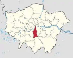
Lambeth (Regatul Unit) Poziția geografică în Regatul Unit | |||
| Coordonate: 🌍 | |||
|---|---|---|---|
| Țară | |||
| Regiune | Londra[*] | ||
| Comitat ceremonial | |||
| Atestare | | ||
| Numit după | Lambeth[*] | ||
| Reședință | Lambeth[*] | ||
| Guvernare | |||
| - leader of Lambeth borough council[*] | Lib Peck[*] | ||
| Suprafață[1] | |||
| - Total | 26,8101 km² | ||
| Populație (2018) | |||
| - Total | 325.917 locuitori | ||
| Fus orar | UTC±0 | ||
| Cod poștal | SE | ||
| Prefix telefonic | 020 | ||
| Localități înfrățite | |||
| - Brooklyn | Statele Unite ale Americii | ||
| Prezență online | |||
| site web oficial OpenStreetMap relation | |||
 Poziția localității Lambeth | |||

This article is issued from Wikipedia. The text is licensed under Creative Commons - Attribution - Sharealike. Additional terms may apply for the media files.