Bromley (burg)
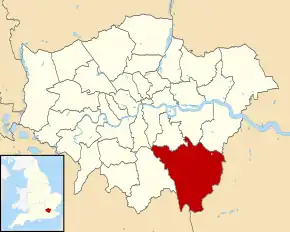
Bromley este un burg londonez în sud-estul extrem al Londrei.
| Anul | Pop. | ±% |
|---|---|---|
| 1801 | 8.944 | — |
| 1811 | 10.186 | +13.9% |
| 1821 | 11.455 | +12.5% |
| 1831 | 13.302 | +16.1% |
| 1841 | 14.878 | +11.8% |
| 1851 | 17.192 | +15.6% |
| 1861 | 33.144 | +92.8% |
| 1871 | 49.095 | +48.1% |
| 1881 | 65.046 | +32.5% |
| 1891 | 84.729 | +30.3% |
| 1901 | 99.502 | +17.4% |
| 1911 | 116.851 | +17.4% |
| 1921 | 140.960 | +20.6% |
| 1931 | 170.073 | +20.7% |
| 1941 | 216.821 | +27.5% |
| 1951 | 276.438 | +27.5% |
| 1961 | 290.065 | +4.9% |
| 1971 | 304.414 | +4.9% |
| 1981 | 294.547 | −3.2% |
| 1991 | 294.723 | +0.1% |
| 2001 | 295.560 | +0.3% |
| 2011 | 309.392 | +4.7% |
| Sursa: A Vision of Britain through time | ||
- https://ons.maps.arcgis.com/home/item.html?id=a79de233ad254a6d9f76298e666abb2b Lipsește sau este vid:
|title=(ajutor)
| Bromley | |||
| — burg[*] și unparished area[*] — | |||
 | |||
| |||
Bromley (Regatul Unit) Poziția geografică în Regatul Unit | |||
| Coordonate: 🌍 | |||
|---|---|---|---|
| Țară | |||
| Regiune | Londra[*] | ||
| Comitat ceremonial | |||
| Atestare | | ||
| Reședință | Bromley[*] | ||
| Guvernare | |||
| - leader of Bromley borough council[*] | Colin Smith[*] | ||
| Suprafață[1] | |||
| - Total | 150,1347 km² | ||
| Populație (2018) | |||
| - Total | 331.096 locuitori | ||
| Fus orar | UTC±0 | ||
| Cod poștal | BR | ||
| Prefix telefonic | 01689 | ||
| Localități înfrățite | |||
| - Neuwied | Germania | ||
| Prezență online | |||
| site web oficial OpenStreetMap relation | |||
 Poziția localității Bromley | |||

This article is issued from Wikipedia. The text is licensed under Creative Commons - Attribution - Sharealike. Additional terms may apply for the media files.