Bexley (burg)
Bexley este un burg londonez în sud-estul extrem al Londrei.
| Anul | Pop. | ±% |
|---|---|---|
| 1801 | 4.165 | — |
| 1811 | 5.164 | +24.0% |
| 1821 | 6.279 | +21.6% |
| 1831 | 7.725 | +23.0% |
| 1841 | 9.616 | +24.5% |
| 1851 | 10.963 | +14.0% |
| 1861 | 16.477 | +50.3% |
| 1871 | 21.991 | +33.5% |
| 1881 | 27.505 | +25.1% |
| 1891 | 35.728 | +29.9% |
| 1901 | 46.904 | +31.3% |
| 1911 | 61.582 | +31.3% |
| 1921 | 77.747 | +26.2% |
| 1931 | 98.160 | +26.3% |
| 1941 | 139.861 | +42.5% |
| 1951 | 199.297 | +42.5% |
| 1961 | 208.138 | +4.4% |
| 1971 | 217.375 | +4.4% |
| 1981 | 214.352 | −1.4% |
| 1991 | 219.422 | +2.4% |
| 2001 | 218.307 | −0.5% |
| 2011 | 231.997 | +6.3% |
| Sursa: A Vision of Britain through time | ||
- https://ons.maps.arcgis.com/home/item.html?id=a79de233ad254a6d9f76298e666abb2b Lipsește sau este vid:
|title=(ajutor)
| Bexley | |||
| — burg[*] și unparished area[*] — | |||
| |||
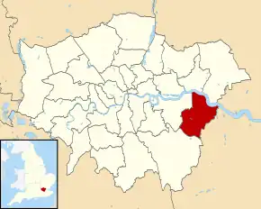
Bexley (Regatul Unit) Poziția geografică în Regatul Unit | |||
| Coordonate: 🌍 | |||
|---|---|---|---|
| Țară | |||
| Regiune | Londra[*] | ||
| Comitat ceremonial | |||
| Atestare | | ||
| Guvernare | |||
| - leader of Bexley borough council[*] | Teresa O'Neill, Baroness O’Neill of Bexley[*] | ||
| Suprafață[1] | |||
| - Total | 60,5763 km² | ||
| Populație (2018) | |||
| - Total | 247.258 locuitori | ||
| Fus orar | UTC±0 | ||
| Cod poștal | DA | ||
| Prefix telefonic | 020 | ||
| Localități înfrățite | |||
| - Arnsberg | Germania | ||
| - Évry | Franța | ||
| Prezență online | |||
| site web oficial OpenStreetMap relation | |||
 Poziția localității Bexley | |||

This article is issued from Wikipedia. The text is licensed under Creative Commons - Attribution - Sharealike. Additional terms may apply for the media files.