Nipissing District
Nipissing District
District de Nipissing | |
|---|---|
District | |
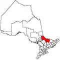
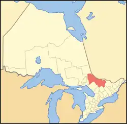 Location of Nipissing District in Ontario | |
| Coordinates: 46°18′00″N 79°27′00″W / 46.30000°N 79.45000°W | |
| Country | |
| Province | |
| Region | Northeastern Ontario |
| Created | 1858 |
| Government | |
| • MPs | Anthony Rota, Cheryl Gallant, Marc Serré |
| • MPPs | Vic Fedeli, John Vanthof, John Yakabuski |
| Area | |
| • Land | 16,986.20 km2 (6,558.41 sq mi) |
| Population (2021)[1] | |
• Total | 84,716 |
| • Density | 5.0/km2 (13/sq mi) |
| Time zone | UTC-5 (Eastern (EST)) |
| • Summer (DST) | UTC-4 (EDT) |
| Postal code FSA | P0A, P0B, P1A-P1C, P2B |
| Area code | 705 |
| Seat | North Bay |
Nipissing District is a district in Northeastern Ontario in the Canadian province of Ontario. It was created in 1858. The district seat is North Bay.
In 2021, the population was 84,716. The land area is 16,986.20 square kilometres (6,558.41 sq mi); the population density was 5.0 per square kilometre (13/sq mi), making it one of the most densely populated districts in northern Ontario.[1]
History
The Sudbury District was created in 1894 from townships of eastern Algoma District and west Nipissing District. The Timiskaming District was created in 1912 from parts of Algoma, Nipissing, and Sudbury Districts.
Subdivisions
City:
- North Bay
Towns:
- Mattawa
- Temagami
- West Nipissing
In addition, the eastern part of the town of Kearney is within Nipissing District, but the entire town is enumerated with the Parry Sound District.
Townships:
- Bonfield
- Calvin
- Chisholm
- East Ferris
- Mattawan
- Papineau-Cameron
- South Algonquin
Unorganized areas:
- North Part (Local services boards in this unorganized areas include Redbridge, Thorne, and Tilden Lake)
- South Part
First Nation reserves
- Bear Island 1
- Nipissing 10
Demographics
As a census division in the 2021 Census of Population conducted by Statistics Canada, the Nipissing District had a population of 84,716 living in 37,252 of its 41,974 total private dwellings, a change of 1.9% from its 2016 population of 83,150. With a land area of 16,986.2 km2 (6,558.4 sq mi), it had a population density of 5.0/km2 (12.9/sq mi) in 2021.[1]
| 2021 | 2016 | 2011 | |
|---|---|---|---|
| Population | 84,716 (+1.9% from 2016) | 83,150 (-1.9% from 2011) | 84,736 (0.1% from 2006) |
| Land area | 16,986.20 km2 (6,558.41 sq mi) | 17,103.78 km2 (6,603.81 sq mi) | 17,103.52 km2 (6,603.71 sq mi) |
| Population density | 5.0/km2 (13/sq mi) | 4.9/km2 (13/sq mi) | 5.0/km2 (13/sq mi) |
| Median age | 46.8 (M: 45.6, F: 48) | 45.9 (M: 44.9, F: 46.8) | |
| Private dwellings | 41,974 (total) 37,252 (occupied) | 41,200 (total) 36,050 (occupied) | 41,023 (total) |
| Median household income | $72,500 | $60,303 |
|
|
| |||||||||||||||||||||||||||||||||||||||||||||||||||||||||||||||
| 2011, 2006, and 2001 excludes census data for one or more incompletely enumerated Indian reserves or Indian settlements. Population counts are not adjusted for boundary changes. Source: Statistics Canada[1][5] | |||||||||||||||||||||||||||||||||||||||||||||||||||||||||||||||||
See also
- Census divisions of Ontario
- List of townships in Ontario
- List of secondary schools in Ontario#Nipissing District
References
- 1 2 3 4 5 "Nipissing, District (DIS) Census Profile, 2021 Census of Population". www12.statcan.gc.ca. Government of Canada - Statistics Canada. Retrieved 11 December 2024.
- ↑ "2021 Community Profiles". 2021 Canadian census. Statistics Canada. February 4, 2022. Retrieved 2022-04-27.
- ↑ "2016 Community Profiles". 2016 Canadian census. Statistics Canada. August 12, 2021. Retrieved 2024-12-11.
- ↑ "2011 Community Profiles". 2011 Canadian census. Statistics Canada. March 21, 2019. Retrieved 2012-03-19.
- ↑ "1971 Census of Canada - Population Census Subdivisions (Historical)". Catalogue 92-702 Vol I, part 1 (Bulletin 1.1-2). Statistics Canada: 76, 139. July 1973.
External links
 Media related to Nipissing District, Ontario at Wikimedia Commons
Places adjacent to Nipissing District | ||||||||||||||||
|---|---|---|---|---|---|---|---|---|---|---|---|---|---|---|---|---|
| ||||||||||||||||
| Cities |
|  |
|---|---|---|
| Towns |
| |
| Townships |
| |
| First Nations |
| |
| Indian reserves |
| |
| Unorganized areas |
| |
| Local services boards |
| |
| ||
Subdivisions of Ontario | |
|---|---|
| Counties | |
| Districts | |
| Regional municipalities |
|
| Single-tier municipalities |
|
| Separated municipalities |
|
| Regions |
|
| |